Overview
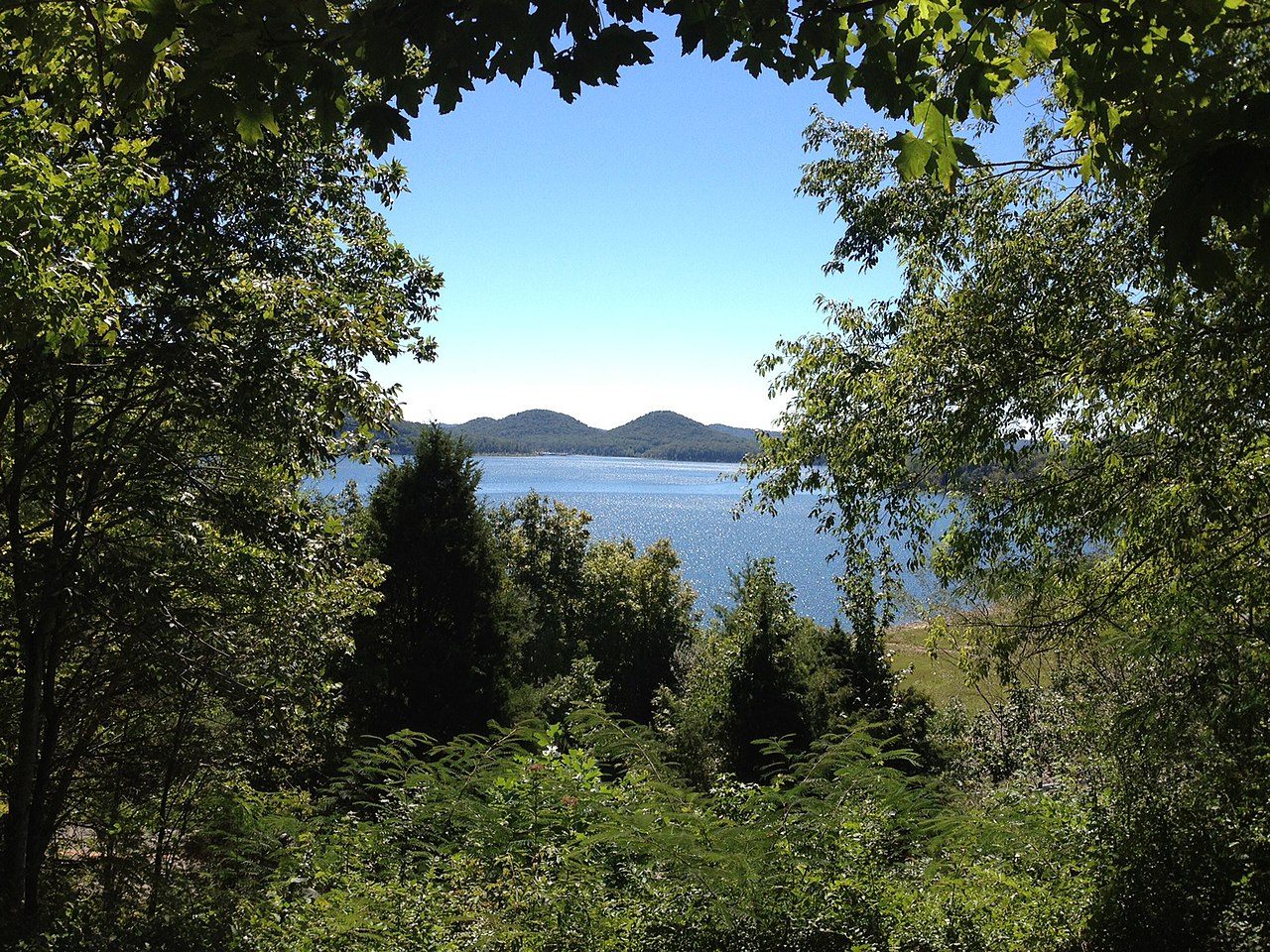
The Daniel Boone National Forest in Kentucky embraces some of the most rugged terrain west of the Appalachian Mountains.
3 things to do · 10 places to stay
Updated from Wikivoyage on 1 October 2026 · Something wrong or missing? Improve it on Wikivoyage
Best things about Daniel Boone National Forest

Cave Run Lake
is nestled among the rolling hills of northeastern Kentucky. This 8,270-acre lake provides flood protection and a clean water supply to area communities. Tourists enjoy the lake for its scenery and excellent recreation o…

Red River Gorge Geological Area
The Red River Gorge is a scenic natural area with spectacular rock features, including sandstone arches and towering cliffs. Outdoor enthusiasts come to the gorge year-round to enjoy hiking, camping, canoeing, wildlife v…

Laurel River Lake
A lake with 5,600 acres of water surface and nearly 200 miles of tree-lined shore. Visitors can enjoy boating, swimming, fishing and camping in the great outdoors.
Plan your trip
Best time to visit & weather
Most comfortable: Apr–Oct. Summer highs reach about 86°F; winter lows dip to about 21°F. Wettest: May and Jul. (climate data from nearby Natural Bridge State Park)
Blue bars: average daily high and low (°F). Purple columns: average monthly rain and melted snow (inches).
Getting there
- From you: to see whether to drive or fly, and how long it takes.
- LEX Blue Grass Airport, Lexington — 65 mi away. Directions
- TRI Tri-Cities Regional TN/VA Airport, Blountville — 99 mi away. Directions
- TYS McGhee Tyson Airport, Knoxville/Maryville — 102 mi away (major hub). Directions
Major highways providing access to the Daniel Boone National Forest include I-75, I-64, and the Bert T. Combs Mountain Parkway.
Full “Get in” guide ↓Budget & where to stay
No prices are listed for this place yet. See the Sleep guide ↓ for options.
Sample 1-day itinerary
Day 1
- Morning Cave Run Lake, Red River Gorge Geological Area
- Afternoon Laurel River Lake
Stops are grouped by area so each day needs little backtracking. Check opening hours before you go.
Food for you
Food can be found in the communities and state parks within the forest. In the natural areas, the majority of the forest, food must be brought in by the visitor.
What to ask about, for your diet
Diet labels come from each listing's description and cuisine; “likely” means the cuisine usually has good choices, not a promise. Check with the restaurant. Open the food finder
Photos


Map
Every listing with a location. Tap a pin for its Google Maps link.
Understand
The Daniel Boone National Forest stretches over 708,000 acres of land in eastern Kentucky.
History
It was created on February 23, 1937 as the Cumberland National Forest, comprising 350,000 acres. The name was changed to the Daniel Boone National Forest in 1966. The forest has grown to its present size primarily through the acquisition of land from coal and timber companies.
Landscape
The forest lies within the Cumberland Plateau, where steep forested slopes, sandstone cliffs and narrow ravines characterize the land.
Flora and fauna
Climate
Get in
Major highways providing access to the Daniel Boone National Forest include I-75, I-64, and the Bert T. Combs Mountain Parkway.
Fees and permits
See
Do Cave Run Lake
is nestled among the rolling hills of northeastern Kentucky. This 8,270-acre lake provides flood protection and a clean water supply to area communities. Tourists enjoy the lake for its scenery and excellent recreation opportunities. Boating, camping, fishing, hiking, hunting and wildlife viewing are some of the activities enjoyed by visitors.
Do Red River Gorge Geological Area
The Red River Gorge is a scenic natural area with spectacular rock features, including sandstone arches and towering cliffs. Outdoor enthusiasts come to the gorge year-round to enjoy hiking, camping, canoeing, wildlife viewing and other recreation opportunities.
Do
- Boating With many miles of streams and lakes, the forest offers many opportunities for motorized and non-motorized boating. Bodies of water include Cave Run and Laurel River lakes, as well as the Red, Kentucky, Cumberland, and Rockcastle rivers.
- Climbing Rock climbers come from around the world to climb the sandstone cliffs of eastern Kentucky. The overhanging rock faces offer the ultimate climbing challenge. Before climbing, make sure you are properly equipped with the right gear and know-how. There are many regulations in place for climbing in the forest, make sure to check for specific rules for the area you will be climbing in.
- Hiking The national forest offers over 600 miles of hiking trails to explore. Most of the trail system is anchored to the Sheltowee Trace National Recreation Trail. The 290-mile Sheltowee Trace runs from just north of Morehead Kentucky to the Tennessee border at Pickett State Park.
Buy
Being a natural area, there are very few opportunities for shopping outside of the small towns and cities in the region.
Eat
Food can be found in the communities and state parks within the forest. In the natural areas, the majority of the forest, food must be brought in by the visitor.
Drink
Kentucky law prohibits consumption and open containers of alcohol in public places, including national forest land and Kentucky lakes and waterways. So you cannot drink alcohol legally inside the national forest. However, this is a state law, not a federal law, and law enforcement within the park is generally handled by the US Forest Service. Some of the surrounding communities are "dry" as well.
Sleep
The large size of the forest provides many options for getting some sleep.
Cumberland Ranger District
London Ranger District
Stearns Ranger District
Redbird Ranger District
Forest Service Campgrounds
Cumberland Ranger District
Stay Koomer Ridge Campground
A campground operated by the U.S. Forest Service within the Red River Gorge Geological Area. There are 54 tent sites and 19 RV/Trailer sites. No electric or water hookups are available, but all sites have easy access to water hydrants. There are shower houses with flush toilets as well as pit toilets in the campground. Koomer Ridge is open year round, but divided into two seasons. The summer season runs from early April through late October. During this time all sites and facilities are open. Tent sites cost $18 and RV/trailer sites cost $26. From late October through early April, only the tent sites are available at $8 per site. The shower houses are closed during this period. Extra vehicles cost $8 year round. No reservations are accepted. All sites are first come, first serve. There are food storage restrictions in effect due to bear activity in the Red River Gorge and they are actively enforced by the forest rangers.
Stay Twin Knobs Recreation Area
A campground operated by the U.S. Forest Service on the shore of Cave Run Lake. There are 141 RV/trailer sites with electric hook ups and 58 primitive tent sites. All sites have easy access to water and the campground has shower houses with flush toilets. The campground is open from mid March through the end of October. Twin Knobs features a boat ramp and a swimming beach on the lake. Volleyball, basketball courts and horseshoe pits are available. Campsites can be reserved.
Stay Zilpo Recreation Area
A campground operated by the U.S. Forest Service on the shore of Cave Run Lake. There are 172 campsites, 30 of which have electric hook ups. Twelve cabins are available for rent and sleep up to 7 people. Each loop in the campground contains a mixture of tent and RV/Trailer sites and has a shower house with flush toilets. All sites have easy access to water. The campground is open from mid April through Mid October. Zilpo features a boat ramp and a swimming beach on the lake. Some of the sites can be reserved.
Stay Clear Creek Campground
A campground operated by the U.S. Forest Service on the shore of Clear Creek Lake. There are 21 primitive sites available. All sites can accommodate tents and RV/trailers up to 30 feet in length. The campground has vault toilets and drinking water. Clear Creek is open from mid April through the end of November and all sites are first come, first serve. There is a boat ramp available and the campground is next to the remains of the Clear Creek Iron Furnace. The campground provides easy access the trail system around Cave Run Lake.
London Ranger District
Stay Grove Campground
A campground operated by the U.S Forest Service on the shore of Laurel River Lake. There are 52 drive-in sites with water and electric hookups. Four walk-in, tent only, sites with a nearby water source are also available. The campground has shower houses with flush toilets and is open mid-April through mid-October. Reservations are accepted Memorial Day through Labor Day.
Stay Holly Bay Campground
A campground operated by the U.S Forest Service on the shore of Laurel River Lake. There are 75 drive-in sites with water and electric hookups. 19 walk-in, tent only, sites with a nearby water source are also available. The campground has shower houses with flush toilets and is open mid April through mid October. 28 of the drive-in sites can be reserved between Memorial Day and Labor Day. The rest of the campsites are first come, first serve.
Stay Bee Rock Campground
A U.S. Forest Service campground located on the shores of the Rockcastle River. The campground has sites on both sides of the river which are connected by the restored Old Sublimity Bridge (foot traffic only). 29 primitive tent only sites are available first come first serve. The 10 sites on the east side of the river are open year round and the 19 sites on the west side of the river are available from mid-April through mid-October. The campground features vault toilets and potable water during the summer season. During the winter season water is only available from the river and must be purified. Prices range from $8 to $12 per campsite.
Stay Rockcastle Campground
A U.S. Forest Service campground at the mouth of the Rockcastle River where it flows into the Cumberland River. The campground has 27 primitive tent-only campsites available on a first-come, first-served basis. Rockcastle Campground is open from mid-April through mid-November and there are no fees to camp. Vault toilets are available and there are no sources of potable water. All water collected from the river must be purified.
Stay Turkey Foot Campground
A U.S. Forest Service campground on the shore of War Fork Creek. The campground has 15 primitive tent only campsites available on a first-come, first-served basis. Turkey Foot Campground is open from mid-April through mid-November and there are no fees to camp. Vault toilets are available and there are no sources of potable water. All water collected from the creek must be purified. The campground features a picnic area with horseshoe pits.
Stearns Ranger District
Stay Great Meadows Campground
A U.S. Forest Service campground located on the shore of Rock Creek. The campground features 18 primitive campsites that can accommodate tents and RVs up to 35 feet in length. Vault toilets are available. From mid-April through November 1 all campsites are available and there are sources of potable water. During the winter months only 7 campsites are open and there is no potable water. All water obtained from the creek must be purified. There are no fees to camp and all campsites are first come first serve.
Backcountry
Backcountry camping is allowed throughout the forest with some exceptions. Permits are required for camping within the Red River Gorge Geologic area. Campsites may not be within 100 feet (30 m) of cliffs or in rock shelters and must be 300 feet from forest service trails. Camping is prohibited within 300 feet of the shorelines of Cave Run and Laurel River Lakes.
Go next
Ranger Districts
Cumberland Ranger District
The Cumberland Ranger District is the northernmost section of the forest. The two main attractions in this district are Cave Run Lake and the Red River Gorge.
London Ranger District
The central portion of the forest between the Kentucky and Cumberland Rivers. Laurel River Lake is in this district.
Stearns Ranger District
The Stearns Ranger District is the southernmost section of the forest and borders the Big South Fork National Recreation Area
Redbird Ranger District
The easternmost portion of the forest was established in 1964 with the purchase of 60,000 acres for $2 million from the Red Bird Timber Corporation.
Nearby

London
City / town · 15 listings · 16 mi away

Corbin
City / town · 15 listings · 27 mi away

Berea
City / town · 31 listings · 30 mi away

Natural Bridge State Park
Park · 10 listings · 35 mi away

Hazard
City / town · 2 listings · 38 mi away

Richmond
City / town · 16 listings · 39 mi away

Cumberland Falls State Resort Park
Park · 4 listings · 40 mi away

Williamsburg
City / town · 3 listings · 41 mi away
My experience
Write about your trip here. Notes save automatically in this browser as you type; back them up from My journal.