
Overview
Pictured Rocks National Lakeshore is the first of the only three United States National Lakeshores. It is in the Upper Peninsula of Michigan on the southern shore of Lake Superior, and is known for its rugged coastline featuring colorful naturally sculpted rock formations and waterfalls.
Updated from Wikivoyage on 1 October 2026 · Something wrong or missing? Improve it on Wikivoyage
Plan your trip
Getting there
- From you: to see whether to drive or fly, and how long it takes.
- MQT Marquette Sawyer Regional Airport, Gwinn — 54 mi away. Directions
- ESC Delta County Airport, Escanaba — 69 mi away. Directions
- GRR Gerald R. Ford International Airport, Grand Rapids — 257 mi away (major hub). Directions
The Lakeshore is located east of Munising and west of Grand Marais, Michigan.
Full “Get in” guide ↓Budget & where to stay
No prices are listed for this place yet. See the Sleep guide ↓ for options.
Food for you
What to ask about, for your diet
Diet labels come from each listing's description and cuisine; “likely” means the cuisine usually has good choices, not a promise. Check with the restaurant. Open the food finder
Understand
History
Landscape
Flora and fauna
Climate
Visitor information
Get in
The Lakeshore is located east of Munising and west of Grand Marais, Michigan.
Fees and permits
An entrance fee of $15 is charged for visitors entering by foot or snowmobile, $20 if entering by motorcycle, and $25 if entering by private vehicle (up to 6 passengers). Additional fees are charged for overnight camping at campgrounds and at backcountry campsites.
See
Miner's Castle and Miner's Falls
Chapel Rock and Chapel Falls
Grand Portal Point
Indian Head Point
Au Sable Point Lighthouse - Shipwrecks along the beach west of the lighthouse
Log Slide at Grand Sable Dunes - logs were pushed down the log slide by lumberjacks into Lake Superior to be more easily transported.
Beaver Lake
Do
Go hiking!
The Pictured Rocks may be more easily seen by tour boat, which sail from Munising.
Sleep
Lodging
Camping
Backcountry
Stay safe
Those rock formations aren't just pretty; they're dangerous. Falls from them have been fatal.
Go next
Tahquamenon Falls State Park, featuring one of the largest waterfalls east of the Mississippi, is a couple hours' drive to the east. The Yooper metropolis of Marquette is a similar distance to the west, along the lakeshore. Other notable State and National Parks/Lakeshores within a few hours' drive are Sleeping Bear Dunes National Lakeshore, in the Northern Lower Peninsula, Mackinac Island, Isle Royale, Porcupine Mountains in the western Yoop and the Apostle Islands National Lakeshore in northwest Wisconsin.
Nearby

Munising
City / town · 28 listings · 19 mi away

Newberry
City / town · 2 listings · 41 mi away

Manistique
City / town · 5 listings · 42 mi away
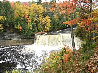
Tahquamenon Falls
Park · 50 mi away

Marquette
City / town · 49 listings · 52 mi away
Garden
City / town · 2 listings · 56 mi away
Gladstone
City / town · 2 listings · 60 mi away

Paradise and Whitefish Bay
Rural area · 9 listings · 60 mi away
My experience
Write about your trip here. Notes save automatically in this browser as you type; back them up from My journal.