
Overview
Colorado National Monument is a United States national monument in Northwestern Colorado.
1 places to stay
Updated from Wikivoyage on 1 October 2026 · Something wrong or missing? Improve it on Wikivoyage
Plan your trip
Best time to visit & weather
Most comfortable: Apr–Jun, Sep–Oct. Summer highs reach about 93°F; winter lows dip to about 21°F. Very hot (Jul, Aug) — plan outdoor time for mornings. Cold months (Jan, Dec) can bring snow and ice; check road conditions. Wettest: Sep and Oct.
Blue bars: average daily high and low (°F). Purple columns: average monthly rain and melted snow (inches).
Getting there
- From you: to see whether to drive or fly, and how long it takes.
- GJT Grand Junction Regional Airport, Grand Junction — 10 mi away. Directions
- MTJ Montrose Regional Airport, Montrose — 56 mi away. Directions
- SLC Salt Lake City International Airport, Salt Lake City — 212 mi away (major hub). Directions
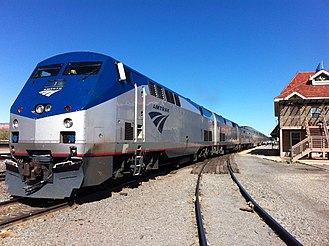
Amtrak serves nearby Grand Junction with the California Zephyr, which runs daily between Emeryville (in the San Francisco Bay Area) and Chicago. For more information, see rail travel in the US.
Full “Get in” guide ↓Budget & where to stay
No prices are listed for this place yet. See the Sleep guide ↓ for options.
Food for you
What to ask about, for your diet
Diet labels come from each listing's description and cuisine; “likely” means the cuisine usually has good choices, not a promise. Check with the restaurant. Open the food finder
Photos


Map
Every listing with a location. Tap a pin for its Google Maps link.
Understand
History
Landscape
Colorado National Monument preserves one of the grand landscapes of the American West. Towering monoliths exist within a vast plateau and canyon panorama. You can experience sheer-walled, red rock canyons along the twists and turns of Rim Rock Drive, where you may spy bighorn sheep and soaring eagles.
Flora and fauna
Climate
Visitor information
Place Saddlehorn Visitor Center
For first-hand information, maps, and brochures, the visitor center is a good place to start your adventure. It is open every day except Thanksgiving Day, Christmas Day and New Years Day. The visitor center includes educational exhibits, an information desk staffed with knowledgeable rangers and volunteers, two twelve minutes movies and a bookstore operated by Colorado National Monument Association.
Get in
- Denver International Airport, (DEN). Commonly referred to as DIA. It is located about 20 miles to the east of downtown Denver. Frontier Airlines, United Airlines, and Southwest Airlines all maintain hubs at the airport in Concourses A, B, and C respectively. Most other major domestic carriers also have service here.
- Grand Junction Regional Airport, (GJT), otherwise known as Walker Field, is served by six airlines with nonstop service to Dallas/Fort Worth, Denver, Salt Lake City, Phoenix, and Las Vegas. Some service is seasonal. For private pilots, it is also possible to fly your small plane into the airport and leave it while you tour the area. Most hotels on Horizon Drive offer shuttle service from the airport. Taxi service is also available at the airport.
By car
- Interstate 70 runs east-west just north of town. Grand Junction is about 30 minutes east of the Utah border and 4 hours west of Denver.
- US 50 runs north-south beginning in downtown, running south to Delta and Montrose, then turning east towards Gunnison and Pueblo.
- US 6 runs east-west parallel to Interstate 70.
- US 139 runs north south, rejoining I-70 west of Grand Junction, in Loma. US 139 travels north over Douglas Pass to Rangely.
By train
Amtrak serves nearby Grand Junction with the California Zephyr, which runs daily between Emeryville (in the San Francisco Bay Area) and Chicago. For more information, see rail travel in the US.
But once at the rail station, you will still have to rent a car.
By bus
- Grand Junction, Clifton and Palisade
By bike
For extreme mountain bikers, it's possible to follow the Kokopelli Trail from Moab, Utah, then join up with the trail system of the monument. This is a five or six day, strenuous excursion where you must pack in your own food, shelter and water.
There's another north-south running slick rock trail that fat tire enthusiasts can follow into town:
Place Tabeguache Trail
Trail crosses public land for 142 miles connecting Montrose and Grand Junction. The Tabeguache Trail begins in Shavano Valley and weaves through the canyons, mesas and highlands of the Uncompahgre Plateau before ending in "No Thoroughfare Canyon," a few miles west of Grand Junction.
Fees and permits
Entrances fees are valid for seven days, allowing unlimited re-entry for the week. Fees as of 2020 are:
- $15 Individual Entrance Fee (Hiker, Bicyclist)
- $20 Motorcycle Entrance Fee
- $25 Private Non-commercial Vehicle Entrance Fee
- $45 Colorado National Monument Annual Pass
Do
- Rim Rock Drive
- Hiking
- Bicycling
- Climbing
- Horseback Riding
Sleep
Lodging
Camping
Stay Saddlehorn Campground
80 sites, 1 group site. 51 sites can be reserved in advance, 29 sites are first-come, first-served. Saddlehorn Campground is located in an area of pinyon pine and Utah juniper trees within walking distance of the visitor center. It is open year-round. Sites have charcoal grills, picnic tables and spaces for tents. Campsites have shared clean toilets and water outlets. Many of the campsites have great views over the valley. Campers need to self-register but there is a camp host on-site.
Backcountry
Backcountry camping is also permitted.
Go next
- Colorado's Wine Country - Colorado is home to over 70 wineries and its own indigenous vineyards. Wine lovers can enjoy several scenic day trips from the Monument to many of the small towns that grow their own grapes. These lovely little communities include Montrose, Palisade, Paonia, Delta and Hotchkiss, as well as the city of Grand Junction.
- The Monument can also act as the hub for a series of day trips to Telluride, Aspen and Vail, as well as Black Canyon of the Gunnison National Park, Dinosaur National Monument, Canyonlands National Park and Arches National Park.
Nearby
Grand Junction
City / town · 66 listings · 7 mi away

Fruita
City / town · 6 listings · 8 mi away

Clifton
City / town · 4 listings · 12 mi away

Palisade
City / town · 8 listings · 18 mi away

Delta
City / town · 28 listings · 39 mi away

Arches National Park
Park · 15 listings · 54 mi away

Hotchkiss
City / town · 41 listings · 55 mi away

Thompson Springs
City / town · 3 listings · 55 mi away
My experience
Write about your trip here. Notes save automatically in this browser as you type; back them up from My journal.