
Overview
Mount Rainier is a city of 8,000 people (2019) in Prince George's County. A large area of Mount Rainier is considered a historic district by the National Register of Historic Places. Mount Rainier still has many of the charms and attractive features that it had in the early 1900s. This article also covers the neighboring community of Brentwood.
2 sights · 2 things to do · 3 places to eat
Updated from Wikivoyage on 1 October 2026 · Something wrong or missing? Improve it on Wikivoyage
Best things about Mount Rainier
The Artspace USA
Gateway Arts District
Spanning two miles along Route 1 Baltimore/Rhode Island Avenue, it has a variety of restaurants, coffee houses, local and regional theatres, galleries, entertainment, and arts-related businesses such as arts and crafts s…
Mount Rainier Nature/Recreation Center
Centrally-located, this all-purpose nature and recreation park is a great place to enjoy the day playing sports, including tennis courts, football field, a swimming pool (summer only), and indoor facilities. Also a place…
Joe's Movement Emporium
In addition to providing dancing and other performing arts classes, Joe's has a variety of performances and other events that are open to the public.
Plan your trip
Best time to visit & weather
Most comfortable: Apr–Oct. Summer highs reach about 90°F; winter lows dip to about 30°F. Very hot (Jul) — plan outdoor time for mornings. Wettest: Jul and Jun. (climate data from nearby Washington, D.C.)
Blue bars: average daily high and low (°F). Purple columns: average monthly rain and melted snow (inches).
Getting there
- From you: to see whether to drive or fly, and how long it takes.
- DCA Ronald Reagan Washington National Airport, Washington — 7 mi away (major hub). Directions
- BWI Baltimore/Washington International Thurgood Marshall Airport, Baltimore — 23 mi away (major hub). Directions
Bus service in the city is operated by the through several lines along US 1 and Maryland Route 500 (Queens Chapel Road). Additional bus service is provided by the Prince George's County Department of Public Works & Transportation (DPW&T) The Bus, which also has several lines along the smaller roads.
Full “Get in” guide ↓Budget & where to stay
No prices are listed for this place yet. See the Sleep guide ↓ for options.
Sample 1-day itinerary
Day 1
- Morning The Artspace USA, Gateway Arts District
- Lunch Glut Food Co-op
- Afternoon Mount Rainier Nature/Recreation Center, Joe's Movement Emporium
- Dinner Grand China
Stops are grouped by area so each day needs little backtracking. Check opening hours before you go.
Food for you
Cuisine (tap to filter)
What to ask about, for your diet
Diet labels come from each listing's description and cuisine; “likely” means the cuisine usually has good choices, not a promise. Check with the restaurant. Open the food finder
Photos


Understand
Incorporated in 1910, Mount Rainier began as a "street car" suburb to Washington, DC, offering cheaper housing and a quieter lifestyle for commuters. It grew considerably until the post-Depression mortgage crisis in the 1940s, then fell into a cycle of abandoned and decaying houses with its commiserate increase in low-income residents during the 1970s.
An urban revival began turning around "historic" Mount Rainier to include an Arts District with loft apartments and storefronts to showcase their art. During May, Mount Rainier's many artisans and businesses throw their doors open to the public. The area has attracted a significant LBGT community and many of the vast number of Sears houses and Craftsman-style homes have now been restored. The town has become a haven for freelance workers in the world of theater, including scenic designers, artistic directors, lighting designers, and stage directors.
Get in
Go Metrobus
Bus service in the city is operated by the through several lines along US 1 and Maryland Route 500 (Queens Chapel Road). Additional bus service is provided by the Prince George's County Department of Public Works & Transportation (DPW&T) The Bus, which also has several lines along the smaller roads.
Go WMATA
Metro service is available in nearby West Hyattsville, but probably not a comfortable walk for most people.
Mount Rainier is also served by the Rhode Island Avenue & Brookland - CUA Metro Station.
Get around
The bus (see Get in) is probably your best option. Like most DC metropolitan neighborhoods, Mt. Rainier is not particularly walk-friendly and considered car-dependent. Driving anywhere requires parking, which is scarce in and around commercial areas.
See
Do
Do Mount Rainier Nature/Recreation Center
Centrally-located, this all-purpose nature and recreation park is a great place to enjoy the day playing sports, including tennis courts, football field, a swimming pool (summer only), and indoor facilities. Also a place to picnic or just walk around with free parking (limited capacity and monitored for time). It provides a much-needed respite from the hustle-bustle of city life.
An extensive hiking trail system run through the community, including the Levee Trail, that started near the Thomas S. Stone Elementary School, running north to and along the Northwest Branch of the Anacostia River (heading East out of town to Rhode Island Avenue). Nearby Colmar Manor Community Park is also available.
Buy
Several commercial areas line the major thoroughfares, most notably the Route 1 corridor. As the neighborhood has become more diverse and new buildings go up, more boutiques and small shops are beginning to appear with very few "big box" stores vying for their business.
For a larger selection, nearby shopping malls are a few bus stops away to the north, east and south, including The Mall at Prince Georges and
Eat
Go next
- Brentwood (to the east)
- Cottage City (to the southeast)
- Colmar Manor (to the southeast)
- Hyattsville (to the northeast)
- Washington, D.C. (to the southwest)
Nearby

Hyattsville
City / town · 22 listings · 1 mi away

College Park
City / town · 48 listings · 3 mi away

Takoma Park
City / town · 43 listings · 3 mi away
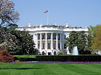
Washington, D.C.
City / town · 218 listings · 4 mi away

Berwyn Heights
City / town · 29 listings · 5 mi away

Silver Spring
City / town · 46 listings · 5 mi away

New Carrollton
City / town · 3 listings · 5 mi away

Greenbelt
City / town · 48 listings · 6 mi away
My experience
Write about your trip here. Notes save automatically in this browser as you type; back them up from My journal.