
Overview
Prince George's County is in the Capital Region of Maryland. The western border of the county is the Washington D.C. city line.
4 sights · 7 things to do · 4 bars & cafés
Updated from Wikivoyage on 1 October 2026 · Something wrong or missing? Improve it on Wikivoyage
Best things about Prince George's County
Joint Base Andrews
NASA Goddard Space Flight Center
University of Maryland
Greenbelt Park
Cedarville State Forest
Cedarville State Forest features camping; hiking, biking and equestrian trails in a cedar forest; hunting in season (license required) and fishing in a four-acre pond stocked with Bluegill, Catfish, Sunfish and Bass (lic…
National Harbor
Harbor, restaurants, the Tanger Outlets, a convention center with restaurants and hotels, and the Capital Wheel, a 180-foot Ferris wheel. Accessible by Metrobus.
Plan your trip
Best time to visit & weather
Most comfortable: Apr–Oct. Summer highs reach about 90°F; winter lows dip to about 30°F. Very hot (Jul) — plan outdoor time for mornings. Wettest: Jul and Jun. (climate data from nearby Washington, D.C.)
Blue bars: average daily high and low (°F). Purple columns: average monthly rain and melted snow (inches).
Getting there
- From you: to see whether to drive or fly, and how long it takes.
- DCA Ronald Reagan Washington National Airport, Washington — 10 mi away (major hub). Directions
- BWI Baltimore/Washington International Thurgood Marshall Airport, Baltimore — 26 mi away (major hub). Directions
Important highways through Prince George's County include I-95 and I-295 (Baltimore-Washington Parkway), which go north from Washington, D.C. to Baltimore. The Beltway (I-495) runs through Prince George's County as it circles around Washington, D.C. Route 50 goes east to Annapolis. To get off the highways to find shopping, restaurants and hotels, look for Route 1 (Baltimore Avenue), Route 193 (Greenbelt Road), Route 450 (Annapolis Road), Route 202 (Largo Road), Route 3 & 301 (Crain Highway), Route 4 (Pennsylvania Ave) and Route 5 (Branch Ave).
Full “Get in” guide ↓Sample 3-day trip
- Day 1: College Park — College Park Aviation Museum, University of Maryland, College Park, Adele H. Stamp Student Union.
- Day 2: Greenbelt — NASA/Goddard Visitor Center, Greenbelt Park, Buddy Attick Park.
- Day 3: Berwyn Heights — O'Dea House, Bell-Dowd House, Bonnet-Duck House.
Built from the best-covered destinations in this region; open each for its own day plan.
Food for you
Although not known as a fine dining destination, Prince George's County has its hidden gems. If you want to splurge, go into D.C. or Montgomery County, but for adventurous dining on a budget avoid the chains and explore Prince George's County's many locally-owned restaurants. Clustered around the University of Maryland campus, downtown College Park has many low-priced restaurants catering to the students. Pasta Plus in Laurel is hard to find and usually has a long line since they don't take reservations, but the food is worth the wait. Along route 1 in Hyattsville, College Park, Beltsville and Laurel there are a wide variety of ethnic restaurants with African, Caribbean and South and Central American cuisines.
Cuisine (tap to filter)
What to ask about, for your diet
Diet labels come from each listing's description and cuisine; “likely” means the cuisine usually has good choices, not a promise. Check with the restaurant. Open the food finder
Photos


Places in Prince George's County

College Park
City / town · 48 listings

Greenbelt
City / town · 48 listings

Berwyn Heights
City / town · 29 listings

National Harbor
City / town · 28 listings

Hyattsville
City / town · 22 listings

Laurel
City / town · 21 listings

Bowie
City / town · 19 listings

Clinton-Camp Springs
City / town · 16 listings

Largo
City / town · 15 listings

Upper Marlboro
City / town · 12 listings

Beltsville
City / town · 9 listings

Mount Rainier
City / town · 9 listings

Fort Washington
City / town · 5 listings

New Carrollton
City / town · 3 listings

Suitland
City / town · 2 listings
Map
Every listing with a location. Tap a pin for its Google Maps link.
Understand
Prince George's County is the wealthiest U.S. county with an African-American majority population. One will sometimes hear it abbreviated "P.G.", although this abbreviation irritates some county residents.
The county is very diverse, both ethnically and economically. Inside the Beltway, there is a pretty clear division between northern P.G. County (northeast of D.C.) and southern P.G. County (southeast of D.C.). The former is significantly more densely populated and wealthy than the latter, which has much in common with the even poorer neighboring areas in southeastern D.C.. Just outside the Beltway, there are suburban bedroom communities like Laurel, Bowie and Upper Marlboro, with rural areas further out.
Cities
U.S. Highway 50 bisects the county, dividing it into the more densely-populated northern county and the more agricultural southern part. Exceptions exist, though, and both Bowie and Landover straddle the highway.
North of US Highway 50
- Beltsville
- Berwyn Heights
- Bowie
- College Park
- Greenbelt
- Hyattsville
- Largo
- Laurel
- Mount Rainier
- New Carrollton
South of US Highway 50
- Clinton-Camp Springs
- Fort Washington
- National Harbor
- Suitland
- Upper Marlboro
Get in
By car
Important highways through Prince George's County include I-95 and I-295 (Baltimore-Washington Parkway), which go north from Washington, D.C. to Baltimore. The Beltway (I-495) runs through Prince George's County as it circles around Washington, D.C. Route 50 goes east to Annapolis. To get off the highways to find shopping, restaurants and hotels, look for Route 1 (Baltimore Avenue), Route 193 (Greenbelt Road), Route 450 (Annapolis Road), Route 202 (Largo Road), Route 3 & 301 (Crain Highway), Route 4 (Pennsylvania Ave) and Route 5 (Branch Ave).
By train
Amtrak stops in New Carrollton as part of its Northeast Regional Service.
Maryland Area Rail Commuter (MARC) operates the Penn and Camden lines with daily service between Washington and Baltimore.
= [https://www.mta.maryland.gov/schedule/marc-penn Penn Line] =
Go Seabrook Station
Go Bowie State Station
= [https://www.mta.maryland.gov/schedule/marc-camden Camden Line] =
Go Riverdale
Go Greenbelt Station
Go Muirkirk Station
Go Laurel Station
By Metro
WMATA provides rail and bus service.
Orange Line
Green Line
Blue/Silver Line
Within Prince George's County, the two lines are the same.
By bike
Prince George's County contains the intersection between two major long-distance biking trails.
The American Discovery Trail enters Prince George's County on local roads south of Route 50, joins the Washington, Baltimore and Annapolis Rail Trail into Odenton and Bowie. It passes through the Beltsville Agricultural Center, heads south through Greenbelt and Greenbelt Park. It then joins the Anacostia Stream Valley trail heading south into DC.
The East Coast Greenway Trail heads north out of DC through Hyattsville, College Park, Berwyn Heights, and Greenbelt. It then turns east through Bowie towards Annapolis before leaving the County.
Get around
The county is served by WMATA's Metrorail and Metrobus, as well as the county's bus system called TheBus.
By taxi
See
See University of Maryland
Parks
Do
Prince George's County has several theaters that put on musicals, dramas, comedies and children's plays throughout the year, including the Greenbelt Arts Center, the Laurel Mill Playhouse and the Bowie Playhouse. The Clarice Smith Performing Arts Center in College Park hosts concerts, plays and dance performances by both University of Maryland students and visiting professionals. For concerts, go to Prince George's Publick Playhouse in Cheverly, Harmony Hall in Fort Washington or Montpelier Mansion in Laurel.
Do National Harbor
Harbor, restaurants, the Tanger Outlets, a convention center with restaurants and hotels, and the Capital Wheel, a 180-foot Ferris wheel. Accessible by Metrobus.
Eat
Although not known as a fine dining destination, Prince George's County has its hidden gems. If you want to splurge, go into D.C. or Montgomery County, but for adventurous dining on a budget avoid the chains and explore Prince George's County's many locally-owned restaurants. Clustered around the University of Maryland campus, downtown College Park has many low-priced restaurants catering to the students. Pasta Plus in Laurel is hard to find and usually has a long line since they don't take reservations, but the food is worth the wait. Along route 1 in Hyattsville, College Park, Beltsville and Laurel there are a wide variety of ethnic restaurants with African, Caribbean and South and Central American cuisines.
Drink
Franklin's in Hyattsville and DuClaw in Bowie brew their own beer on site. The New Deal Cafe in Greenbelt has live music 6 nights per week; the Old Bowie Town Grille and the Old Line Bistro in Beltsville also have live music on some nights.
Prince George's County's Legacy Wine Trail is the closest wine region to Washington, DC.
Drink Janemark Winery & Vineyard
Drink Robin Hill Farm and Vineyards
Drink Gemeny Winery and Vineyards
Stay safe
Crime
Prince George's County is known for having a higher-than-average crime rate compared to the rest of the D.C. metro area. However, as in many places, a lot of the worst crime occurs between people who are already acquainted with each other, or is drug-related.
In addition, Metro parking lots in Prince George's County, especially Greenbelt and New Carollton, have higher than average incidences of car break-ins, so avoid leaving anything of value in sight when leaving your car in these parking lots. So, please, when parking your car, hide any valuables from plain sight. If you leave anything in sight of a thief, they may smash your car window to steal it.
Go next
Washington, D.C., the nation's capital, has many unique attractions: the Smithsonian museums, shopping in Georgetown, visiting the government buildings, fine dining and an active nightlife. Annapolis and Baltimore are other nearby cities. Montgomery County to the west, has upscale urban areas like Bethesda, sub-urban areas, and rural parts. Go northwest to reach the mountainous areas near Frederick. Head south to Southern Maryland or across the Bay Bridge to the Eastern Shore for adventures along the Chesapeake Bay and the Atlantic Ocean.
Nearby
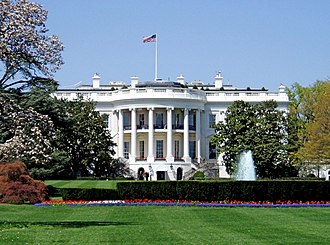
Washington, D.C.
City / town · 218 listings · 11 mi away

Alexandria
City / town · 70 listings · 11 mi away

Arlington National Cemetery
Park · 17 listings · 12 mi away
Waldorf
City / town · 4 listings · 13 mi away

Takoma Park
City / town · 43 listings · 13 mi away

South Alexandria
City / town · 10 listings · 14 mi away

Arlington
City / town · 1 listings · 14 mi away

Silver Spring
City / town · 46 listings · 15 mi away
My experience
Write about your trip here. Notes save automatically in this browser as you type; back them up from My journal.