Overview
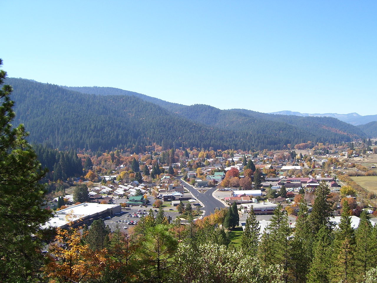
Quincy is a city in Plumas County, California. It sits in the heart of California's Gold Country where gold miners from all over came for their chance at gold in the 1800s. It is a small town of around 5,000 people with a bookstore, an art gallery, a movie theater, and a few places to shop.
3 sights · 3 things to do · 16 places to eat · 7 places to stay
Updated from Wikivoyage on 1 October 2026 · Something wrong or missing? Improve it on Wikivoyage
Best things about Quincy
Plumas County Museum
A couple of buildings of artifacts and cultural displays as well as an outside back patio area with displays including a giant gold mining stamp mill. Before visiting the museum, please call to make sure they are open.
Plumas Arts Gallery
Main Street Artist Gallery
Sierra Bella Lanes Bowling
West End Theatre
live theatre, children's theatre
Town Hall Theater
Plan your trip
Best time to visit & weather
Most comfortable: Jun–Sep. Summer highs reach about 84°F; winter lows dip to about 15°F. Cold months (Dec) can bring snow and ice; check road conditions. Wettest: Jan and Dec. (climate data from nearby Truckee)
Blue bars: average daily high and low (°F). Purple columns: average monthly rain and melted snow (inches).
Getting there
- From you: to see whether to drive or fly, and how long it takes.
- TKF Truckee Tahoe Airport, Truckee — 61 mi away. Directions
- RNO Reno Tahoe International Airport, Reno — 70 mi away (major hub). Directions
It's on Highway 70 in Northern California in the northern end of the Sierra Nevada mountain range. Quincy is between Oroville and Portola.
Full “Get in” guide ↓Budget & where to stay
No prices are listed for this place yet. See the Sleep guide ↓ for options.
Sample 2-day itinerary
Day 1
- Morning Plumas County Museum, Main Street Artist Gallery
- Lunch Angela's Bakery
- Afternoon West End Theatre
- Dinner Midtown Coffee
Day 2
- Morning Plumas Arts Gallery, Sierra Bella Lanes Bowling
- Lunch La Cabana
- Afternoon Town Hall Theater
- Dinner Grandma Jane's Place Bakery
Stops are grouped by area so each day needs little backtracking. Check opening hours before you go.
Food for you
Cuisine (tap to filter)
What to ask about, for your diet
Diet labels come from each listing's description and cuisine; “likely” means the cuisine usually has good choices, not a promise. Check with the restaurant. Open the food finder
Photos


Map
Every listing with a location. Tap a pin for its Google Maps link.
Get in
By car
It's on Highway 70 in Northern California in the northern end of the Sierra Nevada mountain range. Quincy is between Oroville and Portola.
To the north on Highway 89 is Greenville and then Chester. Quincy is at 3,432 ft above sea level, which brings snow in the winter. During snow storms and fog, check for road conditions before traveling there.
Highway 70 on the west side of Quincy is the North Fork Feather River in the Feather River Canyon which is over an hour's drive on windy roads and through some great tunnels and over some great bridges.
Coming from the east is around an hour and a half drive from Reno, more or less.
Get around
On the northwest side, Quincy begins at Gansner Park at Spanish Creek on Highway 70. Then there is the Gansner Field Airport. But before this there is a turnoff West to Feather River College on Golden Eagle Ave. Highway 70 is now called Crescent Street from here to downtown. As you get closer to downtown you will notice a giant white building up ahead which is the Plumas County Courthouse. Right before you get there the street splits up to 2, 1-way roads and turns left. The east-bound road is Main Street and the west-bound road is Lawrence Street. Right after it splits up, there is another intersection which Main Street turns into Bucks Lake Road which goes out of town toward the hospital, Meadow Valley, and Bucks Lake which goes West. Going East on Main Street is downtown Quincy where you will see many small shops, restaurants, etc. If you are heading toward Plumas County Museum, you will want to go behind the Plumas County Courthouse to Jackson Street. Across the street from the museum on Jackson Street is the Plumas County Library. Going East on Main Street you eventually get to the Post Office on the left side. The Post Office is in the middle of Main Street and Lawrence Street (which is the west-bound road). A little farther down Main Street you will get to where Lawrence Street and Main Street come together again and form the 2-way Main Street again. A short distance from there is the shopping center on the right side and the stop lights. On the left side is the High School. Going past that you will start climbing up a short hill and over and back down and now you are in East Quincy. East Quincy has the Plumas County Fairgrounds which is the turnoff on the left-side. East Quincy also has a shopping center on the left and more shops, restaurants, etc. Past East Quincy and you will be on Highway 70 going East toward Portola, CA and it ends at Highway 395 which goes to Reno.
See
There are a lot of nice forests, streams, and lakes to camp and explore around Quincy.
See Main Street Artist Gallery
Do
Fishing, hunting, camping, and hiking surrounds Quincy in Plumas County in the Sierra Nevada mountain range. You can go to the yearly county fair, see a movie at the theater, visit the many shops and restaurants, and spend an afternoon at Gansner Park at Spanish Creek. You can also take a short drive to Snake Lake off Bucks Lake Road. If you like golf, you can take a day-trip to the town of Graegle to the East on Highway 70 and play a round. But fishing, hiking, hunting, camping, and boating are the main attractions around this great community.
Buy
Groceries
Shop Safeway
Shop Sav Mor Foods
Shop Grocery Outlet
Shop Dollar General
Pharmacies
Shop Quincy Pharmacy
Books
Toys
Shop The Toy Store
Clothing
Shop T's 2 Go
Thrift Stores
Shop Quincy Thrift
Shop Bargain Boutique
Shop The Hope Chest
Other
Shop Downtown Barber Shop
Eat
Eat Carey Candy Co. (Quincy Provisions)
Sleep
Stay Spanish Creek Motel
Stay Quincy Courtyard Suites
Go next
Quincy is a starting point to many campgrounds and lakes in the area. Bucks Lake and Snake Lake have campgrounds off Bucks Lake Road. Or you can venture and camp at many other lakes in the region: Lake Davis near Portola off Highway 70, Round Valley Reservoir near Greenville off Highway 89, Lake Almanor near Chester off Highway 89, Mountain Meadows Reservoir near Westwood off Highway 36, Antelope Lake near Greenville (but before you get to Greenville you turn East) off Highway 89, and the Gold Lake region near Graegle off Highway 70. Please bring a map to make traveling easier.
Nearby

Chester
City / town · 21 listings · 30 mi away
Sierra City
City / town · 8 listings · 30 mi away
Susanville
City / town · 5 listings · 37 mi away
Mill Creek
City / town · 1 listings · 41 mi away
Loyalton
City / town · 3 listings · 42 mi away

Oroville
City / town · 25 listings · 44 mi away

Lassen Volcanic National Park
Park · 21 listings · 46 mi away

Nevada City
City / town · 18 listings · 47 mi away
My experience
Write about your trip here. Notes save automatically in this browser as you type; back them up from My journal.