
Overview
One of the most diverse states in the Union, California has a culture ranging from the easygoing surf spots on the beaches of Southern California to the glamor of Hollywood, and the counterculture and thriving businesses of the Bay Area. The state, which is on the west coast of the U.S., also varies greatly in natural beauty, from redwood forests on the North Coast to the ski resorts of the rugged Sierra Nevada mountains and the harsh desert of Death Valley. The largest state in the U.S. by population and the third largest by area, California boasts world-famous attractions and sights: Disneyland, the Golden Gate Bridge, the Napa Valley wine country, and the tallest mountain in the contiguous United States, Mount Whitney. Granted statehood in 1850 following the California Gold Rush, it bears the nickname "the Golden State", and the sites of the former goldfields are known as the Gold Country.
1 places to eat
Updated from Wikivoyage on 1 October 2026 · Something wrong or missing? Improve it on Wikivoyage
Plan your trip
Best time to visit & weather
Most comfortable: Mar–May, Oct–Nov. Summer highs reach about 98°F; winter lows dip to about 40°F. Very hot (Jun, Jul, Aug, Sep) — plan outdoor time for mornings. Wettest: Jan and Feb. (climate data from nearby Fresno)
Blue bars: average daily high and low (°F). Purple columns: average monthly rain and melted snow (inches).
Getting there
- From you: to see whether to drive or fly, and how long it takes.
- FAT Fresno Yosemite International Airport, Fresno — 20 mi away (major hub). Directions
- MMH Mammoth Yosemite Airport, Mammoth Lakes — 56 mi away. Directions
There are biosecurity controls; certain goods, such as some fruits and vegetables, can’t be transported from abroad or from other parts of the country.
Full “Get in” guide ↓Sample 3-day trip
- Day 1: San Joaquin Valley — explore the town.
- Day 2: Southern California — explore the town.
- Day 3: Shasta Cascades — explore the town.
Built from the best-covered destinations in this region; open each for its own day plan.
Food for you
California doesn't have a single, well-defined cuisine of its own, but rather has a remarkably diverse food scene defined by its large population of immigrants of varied ethnic backgrounds and its access to one of the most productive agricultural regions on this side of the planet. The culinary style referred to as Californian cuisine or California fusion focuses on imaginative fusions of other cuisines, typically with heavy attention to presentation and an emphasis on using freshly prepared local ingredients, and has been somewhat subsumed into the general trend of "New American" cuisine. Even diners and small mom-and-pop fast food grills have elements of fusion cuisine, as it is common in California for them to serve both burgers and Mexican food.
Californians take fresh food for granted. Most food you will eat in California was harvested within 300 miles (480 km) of your plate, with the exception of certain cereals and tropical crops. California is the leading global source of tree nuts (almonds, pistachios, walnuts) and also leads North America in the production of dairy products and many kinds of fruits and vegetables. Out-of-season crops are usually imported from South America, especially Chile and Brazil.
Cuisine (tap to filter)
What to ask about, for your diet
Diet labels come from each listing's description and cuisine; “likely” means the cuisine usually has good choices, not a promise. Check with the restaurant. Open the food finder
Photos


Places in California

San Joaquin Valley
Region · 9 listings

Southern California
Region · 6 listings

Shasta Cascades
Region · 5 listings

North Coast
Region · 1 listings

Bay Area
Region

Central Coast
Region

Desert
Region

Gold Country
Region

Sacramento Valley
Region

Diving in California
Dive site

Sierra Nevada
Region

California Wine Country
Place

Diablo Range
Place
Understand
History
Human settlement in California goes back 50,000 years; California was home to 30 different tribal groups prior to the arrival of European explorers in the 1500s and now over 120 tribes are left. The first Europeans to discover what is now California were the Spanish and Portuguese. Spanish colonialism was established through twenty-one missions built throughout California by the late 1700s. These missions still survive today, stretching from San Diego on the Mexican border to Sonoma in the northern San Francisco Bay Area.
After the Mexican War for Independence in 1821, California became a part of Mexico for 25 years until 1846, when many of its residents declared a sovereign nation (the California Republic, also called the Bear Flag Republic) before it was annexed by the United States in 1846, and has since then had an image as the "land of opportunity" and the final destination of luck-seekers. The 1848 discovery of gold in the Sierra Nevada mountains kicked off the California Gold Rush, and California's non-native population surged from 15,000 to over 300,000 within two years. People who moved to California during the Gold rush were often called "49ers", a term that was adopted as the name for the San Francisco football team. California became a state in 1850, and its population has increased steadily since then.
Los Angeles, a city which once boasted one of the longest streetcar networks in the world, boomed through defense contractors and later converted to a "freeway" city after the streetcars were dismantled. The city hosted Olympic Games twice (1932 & 1984) at times when the Olympic movement was in crisis and the games were largely seen as successes for the city as well as the Olympic movement. In the post-war years, California (especially the Bay Area) became a hotspot of counterculture, including popular music, the anti-war movement, and the LGBT community. Since the late 20th century, the state and in particular, the Bay Area, has been at the forefront of the Digital Revolution, with innovations such as personal computers and smartphones having been introduced through Silicon Valley.
Today California is the most populous state in the US with over 38 million residents. Taken by itself, California would rank as one of the world's top ten economies and Californian places like Silicon Valley, Hollywood and San Francisco are known globally and have shaped not only American but world culture. Politically, California is seen as a solidly "blue" state: it has a two-thirds majority of Democrats in both chambers of the legislature and often provides the Democratic party with particularly left-wing ideas, especially on social issues. That said, the state actually contains a lot of political diversity, with conservative views prevalent in much of the state outside the densely populated Bay Area and Los Angeles County, particularly in the fertile but relatively sparsely populated Central Valley.
Landscape
With over 160,000 square miles (411,000 km2), the landscape of California is vast and varied, and the stereotypical beach paradise is only the tip of the iceberg. The state contains extremes in elevation, with Mount Whitney at 14,505 ft (4,421 m) being the tallest mountain in the lower 48 states, while less than 200 miles (320 km) away Death Valley, at 282 ft (82 m) below sea level, is North America's lowest point.
California's border to the west is made up of a rugged coastline along the Pacific Ocean. The coastal mountains rise up from the ocean and are home to redwood trees in their northern half. Moving eastward, the Central Valley bisects California from north-to-south, before giving way to the Sierra Nevada mountains, which are home to Yosemite National Park, Sequoia and Kings Canyon National Parks, and other natural wonders. The southeastern part of California is dominated by desert, which covers 25% of California's total area. The Mojave is a high desert, with elevations ranging from 3,000 to 6,000 ft (1,000 to 2,000 m) above sea level. This area receives less than six inches (152 mm) of rain each year.
Climate
The state's climate varies from subtropical at the coast to the brutal winters of the mountains to one of the world's hottest regions in the deserts. Rainfall is more common in the northern part of the state than in the south, and snow is rare except in the mountains. Most precipitation occurs during winter, but California experiences frequent droughts. This has prompted people to install drought-resistant landscaping. In some years, farms lie fallow due to lack of water for irrigation.
The hottest temperature ever recorded in the Western Hemisphere, 134°F (56.6°C) was at Death Valley in 1913, and temperatures here regularly exceed 120°F (50°C) during the summer. In contrast, winter temperatures in the mountains can drop below 0°F (-20°C). In between these extremes there are great local variations in climate due to topography and the influence of the Pacific Ocean upon precipitation and temperature, with temperatures becoming increasingly moderated nearer the coastline.
For swimming, the Pacific Ocean can be surprisingly cold even in July due to currents. September and October are the best months for swimming. Another surprise in coastal areas is the presence of cool temperatures and fog in the mornings through most of the year. To experience California as a sunny place, plan to sleep late.
People
California is a very diverse state with many ethnic groups. California has large populations of people of varied backgrounds such as Mexican, Salvadoran, Guatemalan, Armenian, Iranian, Jewish, Chinese, Russian, Filipino, Eastern Indian, Korean, Japanese, Vietnamese, Cambodian, Thai, and Hmong. California also has large populations of African Americans and Native Americans.
Although typically considered to be a liberal state, Californians have a wide variety of political views which tend to vary based on region. The Central Valley, Orange County, San Diego, and Palm Springs area tend to be more conservative, while Los Angeles County and the San Francisco Bay Area are among the most progressive areas in the country.
California is a large and diverse state, with different cultures in each region.
Holidays
California observes all the federal holidays, except Columbus Day, and adds Farmworkers Day on March 31st (or nearest weekday). However, some cities such as Coronado that have a large population of federal workers or military personnel do observe Columbus Day.
Tourist information
- Visit California website
Regions
California is geographically varied, ranging from warm beaches to snowy mountains to fertile farmland to extreme desert. In the middle of the state is the farmland of the Central Valley, which provides produce to the whole country. The conventional wisdom is that there is a huge difference—and also rivalry—between the Southern California area around Los Angeles (or as Californians often say, “LA”) and Northern California centered around the San Francisco Bay Area. There is also a cultural clash between the large liberal coastal cities, and more conservative parts of the state such as Orange County, the Central Valley, and the far northeast part of the state.
North Coast
Home to the world's tallest trees, the coast redwoods, as well as rugged coastlines and remote nature adventures.
Shasta Cascades
Lakes and mountains off the beaten path in the state's northeast corner.
Sacramento Valley
Home of Sacramento, the state capital, and the urban areas around the city.
Gold Country
Historic foothills leading east to the Sierras; the 1848 discovery of gold in this region brought many Americans to California and helped California become a state less than five years after the territory had been acquired.
Sierra Nevada
California's alpine and skiing region, including Yosemite National Park and Lake Tahoe.
Bay Area
Home to the cities of San Francisco, Oakland, and San Jose, as well as the technology-centered Silicon Valley and sophisticated Wine Country.
San Joaquin Valley
Breadbasket of California and home to a large percentage of America's fruit and vegetable supply.
Central Coast
An isolated stretch of land that features cool mountains and a rugged coastline.
Southern California
Home to the metropolis of Los Angeles, as well as San Diego, Disneyland, Hollywood, and miles of famous beaches.
Desert
Palm trees, Joshua trees, blazing sun, ghost towns and quirky resorts. Miles of Route 66. Home of Death Valley and Joshua Tree National Parks.
Cities
Here are a few of California's most notable cities, listed from north to south.
- Eureka – former logging town with charming Victorian city center, waterfront trails, and Redwood Sky Walk featuring the world's tallest tree species.
- Redding – Sundial Bridge and gateway to a plethora of outdoor adventures ranging from underground caverns to some of the highest volcanic peaks in the United States.
- Sacramento – the laid-back state capital with historic Gold Rush-era quarter of the city, Old Sacramento.
- San Francisco – Golden Gate Bridge, Alcatraz, America's largest Chinatown, cable cars, and Victorian houses.
- San Jose – south of San Francisco, this city is the center of Silicon Valley, and is home to many technology companies and the (in)famous Winchester Mystery House.
- Santa Barbara – city on a south-facing coast which styles itself, with some justification, as "the American Riviera."
- Los Angeles – the state's largest city, and 2nd-largest in the nation. L.A. is home to Hollywood, Venice, The Getty Center, and Griffith Park.
- Palm Springs – desert recreation with golf, spas, resorts, casinos, and the famous aerial tramway.
- San Diego – Balboa Park, Old Town, SeaWorld, San Diego Zoo, and nearby Tijuana, Mexico.
Other destinations
- Big Sur can be loosely defined as the stretch of coastline between Carmel and San Simeon, and the steep cliffs, rocky coast, churning waves, abundant wildlife, redwoods, and remoteness make it a stunningly beautiful drive.
- Death Valley National Park – a place of legend and a place of trial.
- Disneyland – this world-famous amusement park opened its doors in 1955 and today draws around 16 million yearly visitors. The California Adventure theme park was added in 2001 and provides attractions inspired by the state's scenery and movie industry.
- Joshua Tree National Park – combines two different desert ecosystems anchored by the peculiar-looking namesake tree species.
- Lake Tahoe – a deep blue mountain lake, popular for water sports in the summer and skiing in the winter.
- Napa Valley – the premier wine region of the United States, with spas, wine tasting and wine tours; the historic heart of California Wine Country.
- Sequoia and Kings Canyon National Parks – these twin parks hold monuments to nature's size, beauty, and diversity, including the largest tree on Earth, the General Sherman Tree.
- Yosemite National Park – one of the first wilderness parks in the United States, the site of natural wonders such as Half Dome, El Capitan, and numerous waterfalls.
California also has many state parks, approximately half of which are near urban centers. This is in addition to the state's eight national parks found across the state.
Get in
There are biosecurity controls; certain goods, such as some fruits and vegetables, can’t be transported from abroad or from other parts of the country.
There are six border crossings between California and Mexico: two between San Diego and Tijuana, one between Tecate and Tecate, two between Calexico and Mexicali, and one between Andrade and Los Algodones. The United States operates a consulate-general in Tijuana and a consulate in Mexicali. Mexico operates Consulates in Calexico, Fresno, Los Angeles, Oxnard, Sacramento, San Bernardino, San Diego, San Francisco, San Jose and Santa Ana.
By plane
San Francisco International Airport (SFO) and Los Angeles International Airport (LAX) are the most popular entry points with a wide variety of flights from Europe, East Asia, India, Oceania (Australia, Fiji, New Zealand, Tahiti, etc.), Latin America and from various cities in the U.S. on a variety of U.S. and foreign flag carriers. To a lesser extent there are also direct flights from the Middle East (Israel, Qatar, Saudi Arabia, Turkey and the United Arab Emirates) to Los Angeles. They are however also the most crowded and the SFO-LAX route is one of the busiest air corridors in the world causing frequent delays due to congestion. Delays at San Francisco airport due to fog are also somewhat common. If coming from within the U.S. and from Mexico there are other alternate airports in California that are less crowded and may be closer to your final destination. They are:
- Los Angeles area – Hollywood-Burbank Airport (Bob Hope Airport) (BUR) in Burbank (closest to Hollywood and Downtown Los Angeles), John Wayne Airport (SNA) in Orange County (closest to Disneyland & Knott's Berry Farm), Ontario International Airport (ONT) in Ontario (closest to Joshua Tree and the Inland Empire deserts), and Long Beach Airport (LGB) in Long Beach.
- San Francisco Bay Area – Oakland San Francisco Bay Airport (OAK) in Oakland (closer to Downtown San Francisco than SFO), San Jose Airport (SJC) in San Jose (closest to Silicon Valley), and Sonoma County Airport (STS) in Santa Rosa (closest to Wine Country). Both San Francisco and Oakland airports are now connected to the local metro network, BART, while San Jose is connected by Caltrain via a bus route 10 to the 'Santa Clara Station'.
- San Diego International Airport (SAN) in San Diego
- Sacramento Airport (SMF) in Sacramento
- Reno Airport (RNO) in Reno, Nevada is closer to Lake Tahoe than from Sacramento.
- Fresno Airport (FAT) in Fresno, closest to Yosemite NP and the major airport in the San Joaquin Valley.
- Palm Springs (PSP)
- Central Coast – Monterey (MRY) (closest to Big Sur), San Luis Obispo (SBP) (closest to Hearst Castle), and Santa Barbara (SBA).
- Las Vegas (LAS), Nevada is closer to Death Valley NP than from Los Angeles or Ontario.
- Tijuana Airport (TIJ) in Tijuana. If coming from Mexico it may be better to fly to Tijuana on a (Mexican) domestic flight and then cross into San Diego by ground transportation or through its second terminal (CBX) on the American side of the border than on an international flight to San Diego, Los Angeles, or other cities further north. From San Diego, you can continue north to the San Francisco Bay area, Las Vegas, Phoenix or wherever in the U.S. you are continuing to. See By plane under the "Get Around" section for more information.
By train
Amtrak serves several routes into and out of California. If you are going to Los Angeles from the Central Valley, you might have to change to a bus for the last part of the trip, as the only railway connection between the Central Valley and Los Angeles is also one of the busiest freight lines in the United States. Plans to build a new high speed rail line to link San Francisco and Los Angeles are underway, but completion is not scheduled before the late 2020s.
The following Amtrak routes serve California and terminate in Los Angeles or Emeryville:
- The California Zephyr runs daily between Chicago and Emeryville with connections in Omaha, Denver, Provo, Salt Lake City and Reno/Lake Tahoe. This train also stops in the Sierra Nevada (Truckee and Colfax) and the Sacramento Valley (Roseville, Sacramento, Davies and Martinez). Emeryville is the nearest Amtrak station to downtown San Francisco where passengers transfer to the Amtrak Thruway bus to continue across the bay to San Francisco.
- The Coast Starlight runs daily between Los Angeles and Seattle via Portland, Klamath Falls, Redding, San Francisco Bay Area, Santa Barbara, San Luis Obispo and Oxnard.
- The Southwest Chief runs daily from Chicago via Kansas City, Albuquerque, Flagstaff, Williams Junction (nearest stop to the Grand Canyon) and Kingman to Los Angeles. It also makes stops in the Mojave Desert (Needles, Barstow and Victorville); the Inland Empire (Riverside and San Bernardino) and Orange County (Fullerton) and on its way into Los Angeles.
- The Sunset Limited runs three times a week from New Orleans via Houston, San Antonio, El Paso, Tucson and Yuma. Additionally, Amtrak's Texas Eagle service between San Antonio and Chicago incorporates the Sunset Limited to provide a direct connection to Los Angeles with the same stops as the Sunset Limited between San Antonio and Los Angeles. This train also stops in the Inland Empire (Pomona, Ontario and Palm Springs).
Train services are limited to two token lines with hardly any real transport value in Mexico and there are no passenger rail service to anywhere near the U.S./Mexican border from anywhere in Mexico.
By bus
Many bus companies operate services to California. Service is most frequent along the interstates from large cities in neighboring states. See By bus under Get around in the below for a list of bus companies serving the state.
By car
All major road entrances (including entrances from other U.S. States) to California have agricultural inspection stations to ensure that some fruits and vegetables do not cross into a region where they may come into contact with the farms in the Central Valley. Often, travelers are subject to border inspection (somewhat strict for domestic travel) and asked if they have been on a farm or are carrying organic matter with them.
Get around
California is the third largest state of the U.S. by area (after Alaska and Texas). It compares in size with Sweden. However, getting around California can be simple.
By car
In addition to interstates and US highways, California has one of the most expansive state highway systems in the United States. As with all long-distance trips in the United States, a car is generally the best way to get around and see destinations, especially rural ones. However the trip from the northern end of California to the southern end can take well over ten hours as the state's varied and in places rugged terrain can pose obstacles to the road network. The coast routes (State Route 1 and U.S. 101) are much slower and windier than Interstate 5, and GPS travel estimate times may be inaccurate, especially on Highway 1.
Most California drivers are courteous and careful (although speeding is rampant), and the safety and ease of driving in California is comparable to most wealthy countries. Exceptions may be found in the most congested areas of San Francisco and Los Angeles — where potholes, road rage and reckless driving are commonplace — and some country roads in mountain ranges.
Vehicle collisions and other non-congestion traffic problems on highways are reported online on the CHP Traffic Incident Information Page. Traffic congestion is also tracked by most online map sites.
CHP publishes far more details than most jurisdictions. This can help you rapidly assess the severity of a traffic incident, such as the number of parties involved, which lanes are blocked, whether there have been injuries or property damage, whether a vehicle is no longer driveable, and what resources have been summoned to the scene. Knowing that information can mean the difference between choosing to sit and wait it out, finding an alternate route, or turning around and abandoning the journey altogether. However, CHP logs incidents with its unique abbreviations, which are notoriously cryptic at first glance. A glossary of abbreviations is publicly available. For the most severe incidents, CHP will post a SigAlert, meaning that one or more lanes of traffic will be closed for more than 30 minutes. If a county coroner, medical examiner, or a Multidisciplinary Accident Investigation Team (MAIT) are summoned to the scene, then cleanup will take several hours.
Gasoline prices are much more expensive than in other parts of the U.S. Consider public transit in highly populated areas such as the Bay Area where gas is especially expensive.
Freeway signage (and cautions)
California uses the MUTCD (Manual on Uniform Traffic Control Devices) lane marking system standard throughout the United States, in which dashed white lines divide lanes of through traffic and yellow divides opposing traffic (with single dashed indicating passing and double solid indicating no passing). In many urban areas the lane markings are replaced by Botts dots for additional tactile feedback when crossing lanes.
The network of freeways in major population centers is often confusing and intimidating to those unfamiliar with the area, so having a good map is very helpful. The great majority of exits from freeways are on the right. At interchanges between freeways, in most cases, the flow of traffic continues through the left lanes with the transition to the other freeway being in the right lanes.
At some freeway interchanges, Caltrans (California Dept. of Transportation) is notorious for posting advance direction signs that do not correctly explain which lanes correspond to which ramps. Additionally, Caltrans does not always post signs warning of upcoming lane drops or merges.
For example, where a freeway has three through lanes and the central lane splits into two lanes, thus resulting in two ramps with two lanes each, the advance signage may incorrectly imply that only the right lane will break off for the upcoming right-side ramp, thus causing visitors driving in the middle lane to merge unnecessarily into the right lane. And the two lanes on the right-side ramp may suddenly merge into each other without any warning.
These issues frequently result in visitors making wild last-minute lane merges. Approach major freeway interchanges in California with caution.
Mile-based exit numbering is in progress but is still very erratic in areas; an exit number may not be marked at all, may be marked on the last directional sign before the exit, or may be marked on the final "Exit" sign where the exit ramp separates.
Ramp meters
In urban areas, the access ramps to a freeway may have traffic lights for each lane (called ramp meters or ramp metering lights; you'll see warning signs that read "meter on"). During high-traffic times, the traffic light spaces out the vehicles attempting to merge onto the freeway. Be sure to read the sign below the light as ramps can allow 1 to 3 vehicles per green light. Most ramp meters are for ramps from local roads to a freeway, but some freeway junctions have meters on their ramps too.
Toll roads and bridges
Most highways are freely accessible and toll-free. However, California has some toll bridges, toll roads, and tolled Express Lanes. Toll road and bridges are indicated on road signs. When a toll-free road flows directly into a toll road or bridge, there is sometimes a sign for "last exit before toll".
FasTrak electronic toll collection (ETC) via toll transponders or tags is used for all toll facilities. Cash is no longer accepted. FasTrak is not compatible with any other state's ETC system.
Some California toll authorities also allow online pay-by-plate, but if no signage mentions it, assume it is unavailable. If you drive a vehicle through a toll gantry without an active FasTrak account and the toll authority has no pay by plate option, you may receive an expensive ticket for nonpayment of toll.
In Northern California, all major bridges in the San Francisco Bay Area have toll plazas, with tolls charged on traffic in only one direction. The plazas are unmanned and will be replaced with gantries for open-road tolling, but for now, drivers must slow to 20 mph to pass through them.
Southern California has several toll roads in Orange County which use open-road tolling.
"Express Lanes" are high-occupancy (HOV) lanes (carpool lanes) that non-high-occupancy vehicles can often use by paying a toll. Electronic signs will indicate whether the Express Lane is "open to all" (no toll is charged) or "HOV only" (only HOVs eligible for toll-free access may use the lane). If the signs show a price in dollars and cents, it means that non-HOV vehicles may use the Express Lane but will be charged that toll. During times of severe traffic congestion, Express Lanes may charge tolls of $20 or more per vehicle.
HOVs are supposed to be exempt from tolls in Express Lanes. Some Express Lane operators require all HOVs to carry FasTrak Flex transponders to signal their toll-free status. If you are legally using a free carpool lane and a sign warns it will turn into a tolled Express Lane, you must merge immediately back into regular lanes if you do not have FasTrak Flex.
HOV/carpool lanes
Some freeways have a high occupancy vehicle (HOV) lane on the far left. This lane, also called the carpool lane or diamond lane, is marked by:
- a diamond symbol painted on the road surface
- signage on the wall separating the two sides of the freeway, with the diamond symbol
- a double yellow line on the road surface (only in Southern California)
Some freeway access ramps have carpool lanes too; often, the non-carpool lanes will have ramp meter traffic lights while the carpool lane has none.
In most cases, the carpool lane is only for vehicles with 2 or more persons inside, motorcycles, and clean-air vehicles with government-issued "Access OK" stickers. Sometimes, 3 or more persons and/or a FasTrak transponder may be required, so check the signage before entering a carpool lane. Carpool lane restrictions may be enforced 24 hours a day every day, or only when the signage says so (in those cases, it's usually only during rush hour on weekdays).
Carpool lanes in Southern California have limited access points marked by a dashed white line. This is the only point at which a vehicle may legally enter or exit a carpool lane, since you are not allowed to cross a double yellow line.
The minimum fine for unlawful use of a carpool lane is $490.
Traffic safety and law enforcement
All persons in a moving vehicle are required to wear a seatbelt and the driver and all passengers can be individually ticketed for failing to do so. Motorcycle riders must wear a helmet. Cellphone users are required to use a hands-free headset if talking on the phone while driving. Texting by the driver is illegal, as is any action on the phone that forces the driver to touch it more than once (and even single-touch actions are only allowed if the phone is mounted securely rather than hand-held). Unless otherwise signed, right-turns are permitted at red lights following a full stop. If it is raining hard enough to require you to use your windshield wipers, California law requires that your headlights be turned on.
Most California police officers carry radar guns to catch speeding drivers. The California Highway Patrol occasionally flies aircraft overhead to spot speeders and help ground units home in on their positions.
Red light enforcement cameras are in use at many urban intersections, but are marked only by a single "photo enforced" sign before the intersection. Speed enforcement cameras are being piloted in a few cities, including San Francisco and Los Angeles; the cameras are small and hard to spot.
California's laws against driving under the influence of alcohol are very strict; the maximum permissible blood alcohol concentration is 0.08%. All drivers are strongly encouraged to call 911 to report drunk drivers.
California requires disabled out-of-state visitors to apply at the Department of Motor Vehicles (DMV) for a travel placard for handicapped parking. It is valid for 90 days.
Travelers with a non-US driver's license are generally permitted to drive in California. However, travelers who are in California for more than 10 days with some kinds of visas, especially the K-1 non-immigrant visa for future spouses, have run into some difficulties over their place of residence. The DMV refuses to issue drivers' licenses to people with non-immigrant visas, but police have filed charges against some of them for becoming a California resident without promptly obtaining a California license – the very license that the State refuses to issue on the grounds that they haven't legally become residents yet. This risk may be reduced by giving your non-California address as your place of legal residence if stopped by police.
Unlike most states, "lane-splitting" by motorcyclists (i.e. riding down the painted lines between traffic lanes) is legal in California and commonly done in heavy traffic. It's only legal when traffic is going slower than 30 mph, and motorcyclists are only allowed to go 15 mph faster than the general flow of traffic, but many motorcyclists seem to treat this as more of a guideline than a hard and fast rule. As a result, if you're driving a car, take extra care to watch for motorcycles when changing lanes on a major highway.
Major highways
Here are some important highways in California:
- Interstate 5: Runs between San Diego, Los Angeles, and Sacramento, then north into Oregon and Washington.
* State Route 99: Runs along the California Central Valley between Red Bluff, Sacramento, Stockton, Modesto, Fresno and Bakersfield as the Golden State Freeway.
- Interstate 8: Runs between San Diego, Calexico, Yumma, and Casa Grande, Arizona.
- Interstate 10: Runs between Santa Monica, Los Angeles, the Inland Empire and Palm Springs, then over the Colorado River into Arizona and points east.
- Interstate 15: Runs between San Diego, the Inland Empire, Barstow, Las Vegas, Nevada and points north.
- Interstate 40: Runs between Barstow, Needles, then into Arizona, towards Oklahoma City and points east. Interstate 40 bypasses or replaces the old Route 66 between Barstow and Oklahoma City (as County Rd 66 in San Bernardino County).
* Historic Route 66: Now decommissioned, historically connected Los Angeles, the Inland Empire, Barstow, Needles, then into Arizona and points east. It runs alongside I-40 between Barstow and Oklahoma City and alongside or concurrent with I-15 between Barstow and San Bernardino.
- Interstate 80: Runs between the Bay Area, Sacramento, Reno, Nevada, and points east.
- Interstate 405: Runs 72 mi between Northridge and Irvine via Van Nuys, LAX, Culver City, Long Beach, Santa Ana, and point in between as an auxiliary by-pass of I-5 through the Los Angeles Area.
- Interstate 580: Connects the San Francisco Bay Area with Interstate 5 in the Central Valley
- U.S. Highway 50: Runs between Sacramento, South Lake Tahoe, Carson City, Nevada, and points east
- U.S. Highway 101: Runs between Los Angeles, Santa Barbara, then close to the California Coast to the San Francisco Bay, Eureka and points north
* State Route 1: Runs up the California Coast between Orange County, Los Angeles, Monterey, the Bay Area, and Fort Bragg
- 'U.S. Highway 395: Runs along the Eastern Sierras, connecting the Inland Empire and High Desert with Bishop, Reno, and Susanville, then into Oregon and points north
Taxis and rideshares
Taxis and rideshare services (Uber and Lyft) are widely available in and around California's largest cities: San Francisco, Los Angeles (including Orange County), San Diego, and Sacramento. They are less likely to be available in small towns and rural areas.
Robotaxis
Waymo operates a robotaxi service with self-driving vehicles in two service areas: one on the San Francisco Peninsula from San Francisco to downtown San Jose, and another in the western part of Los Angeles south of the Santa Monica Mountains, from downtown Los Angeles to Santa Monica and as far south as Inglewood.
However, Waymo does not yet have authorization to provide service to Los Angeles International Airport. Only San Jose International Airport allows Waymo unrestricted access to pick up and drop off passengers.
Waymo is now able to drive on freeways, and it can also pick up and drop off at San Francisco International Airport, but only at the Rental Car Center (10 minutes to the terminals via AirTrain tram). Both features are subject to wait lists, making them less useful to new users.
By plane
Flying may be a more reasonable option for crossing large expanses of the state. American/American Eagle; United/United Express, Delta, Southwest, JetBlue, Jet Suite X (JSX), and Alaska Airlines offer intrastate flights within the state of California. San Francisco is a hub for United and Alaska; while Los Angeles is a hub for United, American/American Eagle, Delta, JetBlue and Alaska Airlines. The LAX-SFO route is one of the busiest in America which means competitive fares and delays are frequent which is only made worse by the fog that tends to hit San Francisco bay on a regular basis. In addition, the airlines offer flights from different airports in southern California in the south; to the SF Bay area and to Sacramento in the north at competitive rates. A route between lesser-known airports (say, Burbank to Oakland) may save you money and avoid airport chaos compared to LAX-SFO.
The primary airports served by major US carriers, Volaris (from Mexico) and Aeromexico (from Mexico) in California are in:
* Los Angeles area – Los Angeles International (LAX), Burbank-Hollywood Airport (Bob Hope Airport) (BUR) in Burbank, John Wayne Airport (SNA) in Orange County; Ontario Airport (ONT), and a small airport in Long Beach (LGB) * San Francisco Bay Area – San Francisco (SFO), Oakland San Francisco Bay (OAK), San Jose (SJC), and Sonoma County Airport (Charles M. Schulz Airport) (STS) in Santa Rosa; both San Francisco and Oakland airport are now connected to the metro, BART, while San Jose is connected by Caltrain via a free shuttle at the 'Santa Clara Station'. Oakland is closer to Downtown San Francisco than SFO is and offers a fog-free alternative. * San Diego (SAN) * Sacramento (SMF) * Reno (RNO), Nevada closer to the Lake Tahoe area than Sacramento The busiest second tier airports are Fresno (FAT) (nearest to Yosemite NP); Santa Barbara (SBA); and Palm Springs (PSP). There are also flights from major hubs to Arcata/McKinleyville (nearest to Eureka), Bakersfield, Crescent City, El Centro, Mammoth Lakes, Merced, Monterey, Redding, San Luis Obispo, Santa Maria, and Stockton.
By train
The state's various rail services provide a cheap and reasonably comfortable way to see and get around much of the state without a car. Amtrak operates a few long-distance routes through and out of California, as well as the three Amtrak California routes:
* San Luis Obispo-Santa Barbara-Los Angeles-Anahiem-San Diego on the Pacific Surfliner * Oakland/Sacramento-Stockton-Fresno-Bakersfield on the Gold Runner (which has a connecting Thruway bus service to Los Angeles) * San Jose-Oakland-Sacramento-Auburn on the Capitol Corridor * Los Angeles-Santa Barbara-San Luis Obispo-San Jose-Oakland-Sacramento-Redding-(continues to Seattle) on the Coast Starlight * Emeryville (San Francisco connection)-Sacramento-Truckee (near Lake Tahoe)-(continues to Chicago) on the California Zephyr *Los Angeles-Palm Springs-(continues to Chicago) on the Sunset Limited *Amtrak Thruway Motorcoaches connects additional cities and towns to/from the Amtrak (train) network by bus such as Santa Cruz-San Jose; San Francisco-Emeryville; Bakersfield-Los Angeles; Bakersfield-Las Vegas; Martinez-Arcata; Redding-Sacramento; etc. Amtrak has seen continuously increasing ridership in most of the US for more than a decade now, and surprisingly enough three of the six most popular Amtrak routes run through California, thus making them a viable alternative to the more often than not congested roads and airports.
In addition, there are several commuter and regional services in the state's metro areas:
*Caltrain San Francisco-Palo Alto-San Jose-Gilroy through the famous Silicon Valley. * Altamont Commuter Express San Jose-Stockton through the Altamont Corridor Express. * BART operates in the Bay Area, connecting much of the East Bay (Oakland, Berkeley, Walnut Creek) to San Francisco and SFO. * Metrolink runs regional train service throughout the greater Los Angeles, Orange, Riverside, San Bernardino and Ventura County (metropolis) region on multiple routes. * COASTER runs along the coast of San Diego County between downtown San Diego, Carlsbad and Oceanside. *SPRINTER runs across Northern San Diego County between Escondino and Oceanside with bus and train connections to Los Angeles and San Diego. *Sonoma-Marin Rail (SMART) runs between Santa Rosa and San Rafael in Marin/Sonoma County (Northern Bay Area) with ferry connections to San Francisco
There are also light rail systems in San Diego, Los Angeles, San Francisco, Sacramento, and San Jose. Almost all of these systems are being expanded or upgraded to cope with rising ridership, so expect more and better service in years to come.
By bus
The bus is not the most glamorous way to get around the state, but it can be the cheapest. There are fairly frequent service from Los Angeles to San Francisco/San Jose; San Diego/Tijuana; Las Vegas/San Bernardino and Sacramento with on multiple routes with various bus companies. There are other the smaller companies, county bus services, and those connecting rural towns which are not listed, check the article of your destination for all the transportation options. Information on transit can be found here.
Place Eastern Sierra Transit
Operates 'local' buses along US Hwy 395 corridor between Mammoth Lake, Bishop and Lone Pine in Mono and Inyo Counties in the eastern 'Desert' and the Sierra Nevada parts of the state. They have a route continuing north to Carson City & Reno from Mammoth Lake and south to Lancaster from Lone Pine. The area is not served by Greyhound or Amtrak Thruway buses
Go El Paso Los Angeles Limousine Express
Travels along I-10 between Los Angeles, Indio, Phoenix, Las Cruces and El Paso on one route and on I-15 to Las Vegas & North Las Vegas on another route. They have additional stops in E. Los Angeles, El Monte and Colton on their way on both routes. They also have a second depot at 4425 S Atlantic Blvd in E Los Angeles.
Place Flixbus
The German bus company, Flixbus, connects Los Angeles to Las Vegas, Phoenix, Sacramento, SF Bay Area and San Diego via multiple cities en route in Arizona and California. It has grown rapidly through subcontracting its operations, which has the downside for customers that the buses are not of a consistent style or quality. In October 2021 they had merged with Greyhound Lines (see below) but, maintain separate brands. Tickets and schedules with Greyhound and Flixbus can be searched and purchased through each other's websites.
Place Green Tortoise
Operates something like a 'hippie' bus that serves as a bus by day with stops to visit different places like a bus tour throughout the day and a RV camper by night in different campgrounds. It offers bus tours and camping trips to Joshua Tree, Yosemite, Death Valley Sequoia and along the coast between San Francisco and Los Angeles. Some of its tours involve a 3- to 5-day round trip from the point of origin such as from San Francisco to Yosemite NP and back while others are one way where the journey starts from one place and end in the other like from Los Angeles to Joshua Tree and end in Las Vegas. Even with round trips it is possible to ask to be picked up or dropped off in different places than the point of origin/return. Others like its 'Hostel Hoppers' or 'Express' are a straightforward bus ride from point A to B. It is one way to combine 'taking the bus' from one place to another and to visit and see remote places without a private automobile.
Place Greyhound , Cruceros-USA, Flixbus
Greyhound goes to 100 locations statewide, though these are not all actual stations, some are merely stops. In general, Greyhound serves the same routes that Amtrak does along the main highways. In some cases Greyhound is cheaper, faster, and more frequent than Amtrak. Flixbus tickets can also be searched and purchased on Greyhound's website
Go Hoang Express
Travels between SoCal (San Diego, El Monte, Los Angeles, Westminster); Bay Area (San Francisco, San Jose & Oakland) and to Sacramento on another route from Los Angeles. They also offer service from Los Angeles to Arizona (Phoenix, Chandler and Tempe.
Place Mendocino Transit Authority (MTA)
Travels extensively in the North Coast region along Hwy 1 from Ft Bragg to Navarro River Junction (#65), Point Arena (#75), Bodega Bay and Santa Rosa (#95). Another route from Ft Bragg to Willits, Ukiah and Santa Rosa along SR-20 and US Hwy 101 (Rt #65). Much of the area is not served by Greyhound or Amtrak Thruway Buses off the US Hwy 101 corridor.
Place Sage Stage
Provides public transportation from Alturas and Canby in Modoc County, in the Shasta Cascades, to Redding; Reno, NV; and Klamath Falls, OR on three separate routes.
Place Santa Barbara Airbus
Eight trips a day from LAX to Carpinteria, Santa Barbara and Goleta.
Place "Cabin" (formerly Sleep Bus)
Overnight service to the Los Angeles area (Ocean & Arizona Ave in Palisades Park in Santa Monica) from San Francisco (Bayside Lot @ 1 Bryant St). This is an actual sleeper bus featuring twin size bunk beds with privacy curtains, power outlets, and free wifi.
By foot
- The Pacific Crest Trail crosses the length of California on its way from Mexico to Canada
- The American Discovery Trail connects California with Nevada and the East Coast.
By boat
- Ferry service is limited, but can be a scenic, relaxing, and fun way to travel. Major services exist in the Bay Area, to the Channel Islands and to Catalina Island near Los Angeles. Several of the smaller coastal towns have water taxi services within their city. Check as the stops are limited and the schedules may be seasonal.
- Many cities are along the coast, or else on navigable waterways, and you can dock your own boat there.
- Cruise ports in California include San Pedro, Long Beach and San Diego
See
As the most geographically and culturally diverse state in the U.S., California offers an endless amount of things to see and do; even when you think you've experienced everything in one area of the state, a short trip to another part has plenty more to offer.
Incredible and unique scenery, some of the most recognizable landmarks in the world, centuries old historical sites, unending cultural and entertainment options no matter where your interests lie, California will almost certainly offer it.
Natural attractions
From white-sand beaches to snowcapped mountains, with lush forests and arid deserts in between, no other state offers such a wide a variety of natural landscapes as California does.
California hosts the largest number of U.S. national parks with a total of nine. The most famous of these is Yosemite National Park, featuring thundering waterfalls and geological behemoths like El Capitan and Half Dome. The surrounding Sierra Nevada also hosts nearby Sequoia and Kings Canyon National Parks which are both home to some of the world's largest living organisms, the giant sequoia. Redwood National Park in the far northwestern corner of the state and the surrounding area feature the world's tallest species of trees, the coast redwood.
Tired of forests? The California desert is the site of some of the hottest and most arid places on Earth. Death Valley National Park is the location of the highest ever recorded temperature on the planet. If deserts are not your thing, beaches and California are practically synonymous. Big Sur and Point Reyes are notable examples of a scenic, winding stretch of unspoiled coastline that is typical of Northern California, featuring rocky cliffs and towering redwood trees that meet thundering ocean waves. Further south, the water is much warmer and suitable for all-day beach trips. Here, world-class beach towns such as Santa Barbara, Malibu, and those of Orange County offer opportunities to catch waves, practice beach volleyball, or simply lounge around and tan underneath palm trees.
If high-altitude adventure is what you are seeking, California has that too. At an elevation of 14,505 feet (4,421 meters) above sea level, Mount Whitney is the highest mountain in the lower 48 states. Snow activities such as skiing and snowboarding are plentiful in Lake Tahoe in the winter, while hiking and water recreation such as boating are popular in summer.
While the national parks may receive most of the attention, California has the largest state park system in the United States. These protected areas are found in places ranging from being adjacent to national parks to green landscapes in the middle of cities that offer a respite from the hectic urban rush.
California's high population and its climate have also led to the creation of numerous reservoirs.
California marine animals (native and migrating) are easily found in the wild along the state's beaches, in lagoons and estuaries, such as sea otters, grey whales, elephant seals, harbor seals, sea lions as well as multitudes of tide pools dwellers including crabs, sea stars, anemone, and sea urchins. Timing is key: go at low tide to see lots of marine life.
Monuments and architecture
California has long been a canvas for architects and engineers to design and build some pioneering structures or to popularize styles that would define a time period. With two of the most prominent cities in the United States, Los Angeles and San Francisco, this is certainly notable with many of the structures and buildings that are found there.
San Francisco is home to engineering marvels such as the Golden Gate Bridge, Lombard Street (the most crooked street in the world), and cable cars that seemingly glide up and down the hills between the waterfront and rest of downtown. The many skyscrapers such as the Transamerica Pyramid have all been specifically designed to withstand powerful earthquakes. The stately Palace of Fine Arts and charming Painted Ladies of Alamo Square have served as backdrops countless of times for the city by the Bay.
As the epicenter of the global entertainment industry, the Hollywood Sign is an icon of Los Angeles recognized worldwide. The nearby Hollywood Walk of Fame, Capitol Records Building, and numerous theaters all solidify the city's hold on entertainment. The Griffith Observatory and Walt Disney Concert Hall are also notable features in the cityscape, as is the imposing Los Angeles Memorial Coliseum, the site of the 1932 and 1984 Summer Olympics.
Other notable landmarks outside these two cities include the California State Capitol in Sacramento (modeled after the U.S. Capitol in Washington, D.C.), labyrinthine Winchester Mystery House in San Jose with eerie origins, and the lavish Hearst Castle in the Central Coast town of San Simeon that anchors the landscape of the surrounding area.
Historical sites
From former Native American sites to suburban garages where modern technology was invented, California's centuries-long history is preserved in numerous historical sites and museums that are scattered throughout the state.
One of the most comprehensive collections of state history from prehistory to contemporary times is housed in the Oakland Museum of California in Oakland, with a vast collection of nearly 2 million items related to California history, art, and science.
The legacy of Spanish colonial times remains with the string of twenty-one missions that span the length of much of the state from Mission San Diego de Alcalá in the San Diego's Old Town (founded in 1769) up to Mission San Francisco Solano in the Bay Area town of Sonoma (founded in 1823). Perhaps the most beautiful of these though, is Mission Santa Barbara, which lent its name to the same city and is rightfully referred to as the "Queen of the Missions".
El Pueblo de Los Angeles Historical Monument in downtown Los Angeles is another historical feature from the Spanish era, although the neighborhood underwent a major transformation during the period of Mexican rule (1821 to 1848) that now gives the area a distinct Mexican atmosphere, particularly along Olvera Street.
Spain was not the only European power that colonized California, however. Fort Ross in the northern edge of the Bay Area was the southernmost Russian outpost in North America and was in operation from 1812 to 1841.
Gold Rush legacies live on in Gold Country, located in the northeastern part of the state. Following the discovery of gold at Sutter's Mill in Coloma in 1848, hundreds of thousands of fortune seekers from around the world made their way to California, establishing dozens of towns, most of which still retain their Old West charm and atmosphere. Old Sacramento in the state's capital city also sprung up as the commercial and transportation center of this era, with places of interest including the first terminus of the First Transcontinental Railroad and related California Railroad Museum.
Cannery Row and much of the rest of Monterey provide a glimpse of the state's once lucrative fishing and canning industry during the first half of the 20th century, with carefully preserved wooden buildings that housed factory workers and engines, along with rustic (and still active) piers.
Motion picture sets
Countless films and television series have been set in California. Much of the production is made within the 30-mile (50-km) studio zone around Los Angeles, but sceneries across the whole state are famous from the movies. Some franchises with their own itineraries are Back to the Future, Easy Rider, Fast and Furious, Forrest Gump, Kill Bill and The Terminator.
Itineraries
- El Camino Real (The Royal Road) — a historic road linking the 21 Spanish missions of Alta California (modern day state of California) offering a fascinating look into California's history. El Camino Real is most accessible via Pacific Coast Highway (CA-1) and U.S. Highway 101.
- Pacific Coast Highway — tour up and down the iconic California coast, along Big Sur, all the way up to its end where it merges into the US 101, which goes up to Washington state.
- U.S. Highway 395, Interstate 5 & CA-99, Interstate 10, Interstate 80, and the Lincoln Highway are major highways through California with their own Wikivoyage article.
- The old Route 66 (formerly US 66) was a highway in the United States that extended from Chicago to Los Angeles. It crossed much of the American Midwest, Great Plains, and Southwest. In California it winds its way from Santa Monica, across the San Gabriel Valley to San Bernardino as CA-66. From San Bernardino goes up towards Barstow as County Rd 66 where it continues east on or alongside Interstate 40 towards Kingman, Arizona.
Do
- Ski at one of the great resorts near Lake Tahoe or Big Bear.
- Try your hand at surfing or work on your tan in Orange County or Santa Monica.
- The long coastline offers some great California scuba diving.
- Go winetasting at one of the countless vineyards dotting Wine Country.
- Climb a mountain and camp in the Sierra Nevada or Shasta Cascades.
- See California's amazing wildflowers. From March through May, the California Wildflower Hotline at +1 818 768-3533 offers the latest information on the best places to view wildflowers throughout Southern and Central California. The hotline and website are updated every Thursday evening. More than 90 wildflower sites are included. The hotline, founded in 1983, is run by the Theodore Payne Foundation for Wild Flowers and Native Plants.
- Listen to music at the Northern California Blues Festival. The fastest growing festival of its kind comes in June to Sacramento County around Father's day each year and usually features a spectacular line-up of Blues artists. Event benefits Through the Mind, a non-profit providing free alternative mental health to America's Veterans.
- Visit one of the many theme parks, such as Disneyland or Six Flags Magic Mountain.
Buy
Usually US dollars and common credit or debit cards are the only accepted modes of payment. Many stores can take contactless payment methods such as Apple Pay and Google Pay. You might have some luck with Mexican pesos near the immediate border area, but the exchange rates are usually terrible.
California stores no longer give out free plastic bags, except for fresh grocery produce and meats. Reusable plastic bags cost a minimum of ten cents (by state law). Many stores sell cloth bags for one or two dollars.
The state sales tax is 7.25%. However, counties and cities are allowed to levy their own sales taxes on top. In most areas you visit, the actual sales tax will be around 8% or 9%. In certain parts of the counties of Alameda and Los Angeles, actual sales tax is over 10%. In California, sales tax is levied on sales of nearly all tangible personal property. The main exceptions are regular groceries (including cold food-to-go) and prescription drugs. Hot prepared food is also usually taxed, with the exception of hot baked goods sold to go as standalone items. The state does not refund sales tax to travelers.
The quintessential California souvenir depends a lot on which part of the state you visited, and what your interests are. The agricultural products change from citrus and avocadoes down south to strawberries in the middle, to almonds and wine as you move north. In LA, you might take home chocolates from See's Candies; in the Central Coast, keep an eye open for locally produced saltwater taffy; in the Bay Area, it's all about Ghirardelli Chocolate. Common themes for souvenir items include surfing, tie-dyed clothing, and redwood trees.
Eat
California doesn't have a single, well-defined cuisine of its own, but rather has a remarkably diverse food scene defined by its large population of immigrants of varied ethnic backgrounds and its access to one of the most productive agricultural regions on this side of the planet. The culinary style referred to as Californian cuisine or California fusion focuses on imaginative fusions of other cuisines, typically with heavy attention to presentation and an emphasis on using freshly prepared local ingredients, and has been somewhat subsumed into the general trend of "New American" cuisine. Even diners and small mom-and-pop fast food grills have elements of fusion cuisine, as it is common in California for them to serve both burgers and Mexican food.
Californians take fresh food for granted. Most food you will eat in California was harvested within 300 miles (480 km) of your plate, with the exception of certain cereals and tropical crops. California is the leading global source of tree nuts (almonds, pistachios, walnuts) and also leads North America in the production of dairy products and many kinds of fruits and vegetables. Out-of-season crops are usually imported from South America, especially Chile and Brazil.
With such a bounty for restaurants to draw upon, almost any dish you can imagine can be found somewhere in California. The cuisines of the Americas and Asia are heavily represented, and those of nearly every other country are also available to a lesser extent. More "North American" fare includes everything from burger shacks to vegetarian, organic and even completely vegan restaurants; the Californian love for food has made it one of the most diverse restaurant scenes in North America. The large cities have the most variety, while things get simpler and more meat-heavy as you get more rural.
There are a handful of distinctive California dishes, although most of them have been adopted and adapted throughout the US.
- Cobb salad – a cold salad of bacon or ham, chicken, boiled eggs, avocado, tomato, lettuce, and bleu cheese, with a vinaigrette dressing. Traditionally it's chopped fairly fine, but in modern times it's served in a variety of ways, and sometimes with ranch dressing instead of the traditional vinaigrette. It was invented at the Brown Derby restaurant in LA.
- French dip sandwich – invented somewhere in LA, the exact location is subject to dispute, but it's a warm sandwich of thinly sliced roast beef on a roll that's dipped into beef broth.
- Cioppino – a seafood stew developed by Italian immigrants in San Francisco, it resembles various Italian fish stews but includes local ingredients like chopped Dungeness crab.
- The Mission Burrito – a San Francisco tradition characterized mainly by its great size and caloric content, featuring copious amounts of beans and rice in addition to cheese, meat and/or vegetables.
- California Burrito – a San Diego specialty, it's a carne asada (spicy grilled steak) burrito, stuffed with french fries.
- Santa Maria Barbeque – This is a central coast tradition. It's a bottom sirloin beef roast (the cut is locally known as tri-tip), where the fat hasn't been trimmed. It's suspended high above a hot oak fire, fat side up, so it cooks slowly and the fat melts and tenderizes the meat. It's usually served thinly sliced with tortillas or bread, salsa, onions, avocado, and other side dishes.
- Chop Suey – the original "American Chinese" dish was popularized as cheap food for laborers during the California gold rush. While it's increasingly hard to find, many other American Chinese dishes were first created in San Francisco's Chinatown. Larger cities in California have some restaurants selling American Chinese food and others selling traditional Chinese dishes. In smaller cities, the Americanized version may be the only option on the menu.
As a general rule, plain water is free at any restaurant. However, if you need a disposable cup, the cup will cost you 25 cents (by state law). You are allowed to bring your own reusable water cup or bottle.
Regional chains
California's classic burger chain In-N-Out has expanded to states as far east as Texas—see Fast food in the United States and Canada for more. Outside of fast food, California chains that you'll be hard-pressed to find elsewhere include:
Eat Ike's
Casual sandwich joint with more than 50 locations, mostly in California though a few are in Nevada. The menu varies by location, but in general about half the menu has meat and half is vegetarian; many vegetarian options can be made vegan. The sandwiches are filling and flavorful but not excessively heavy.
Drink
Generally, alcohol is available in more places in California than it is in other states. A person with valid ID of age can purchase alcohol at supermarkets or liquor stores; these are regulated by the state but not owned or controlled by them. All but the smallest communities have restaurants or bars that sell beer. Some places are permitted to have a bar in one part of their establishment, and six-packs of beer for sale and offsite consumption in another part.
California is known for its fine wines and gourmet beers. As of March 2026, there are 154 established American Viticultural Areas (AVAs) across the state of California, which is the highest number of any state. Napa, Sonoma and Mendocino are premier wine districts north of San Francisco, but there are others in the Central Coast region (Paso Robles, Solvang) and even down near Temecula where suitable microclimates have been found. The inland Central Valley region (especially near Lodi) has hotter summers and traditionally produced inexpensive bulk wines, but quality has been improving with winemaking innovations.
For beer, California also has a lot of microbreweries. Sierra Nevada, in Chico, is one of the biggest microbreweries in North America. In the Central Coast the mid-sized brewery Firestone Walker in Paso Robles is a good addition to the local wineries in the area; Ventura has had several microbreweries over the years. In San Diego, Stone Brewing Company offers a great variety of beers that can be purchased throughout the state. Los Angeles has several microbreweries, especially in the Arts District. There are over 200 microbreweries in California, and many bars in large- and mid-size cities that have 20 or more beers (often both foreign and domestic and ranging from light beer to flavored stouts) on tap. In addition to microbreweries, there are a handful of distilleries in California; one even makes date vodka.
Legal issues
Californians tend to view wine as a natural accompaniment to food or socializing, overlooking its alcoholic content more easily than with distilled spirits. However police crackdowns on drinking and driving are noticeable, with roadblocks and random checks. Conviction for driving with a blood alcohol level over .08 percent is likely to bring serious legal and financial consequences. Drivers with a lower blood alcohol can still be convicted for DUI (driving under the influence) if they fail field sobriety tests, such as walking a straight line.
You must be 21 years of age to buy or drink any alcoholic beverage. Underage drinking is taken very seriously, so if you want a drink and appear to be under 30, you should be ready to present identification showing your age. The only acceptable proof-of-age documents are passports from any country, and identity documents issued by US government agencies (e.g., drivers' licenses issued by any US state). Foreign drivers' licenses and foreign identity cards are not legally acceptable as proof-of-age documentation, and people who are unable to produce a passport or valid United States ID will be refused service. Only original identity documents will be accepted; photographs or photocopies will not be accepted.
Stay safe
If you find yourself in an emergency situation (of any kind), dial 9-1-1 on your phone or from any (available) phone. It is a free call from a payphone.
California–Mexico border
Due to California's proximity to the international boundary with Mexico, visitors should be cautious while in areas near the border.
- Beware Customs and Border Patrol (CBP) checkpoints and patrols. Non-whites, and especially Latinos, should expect to be profiled, targeted, and harassed by these government agents. There is little you can do about it; just don't lose your temper.
- Don't get lost.
- Do not pick up hitchhikers. If the person is undocumented or carrying drugs, you could be mistaken for a trafficker.
- Keep valuables, including spare change, out of sight and lock your vehicle.
- Avoid traveling along unofficial trails, even when they are well marked.
- Avoid hiking or camping in areas of major border activity. If you are visiting a national or state park, consult park staff to help keeping to safe areas.
Crossing the border
Thousands of U.S citizens visit the state of Baja California, Mexico from California every year, with the majority of travelers returning from an enjoyable experience. However, a minority of travelers do experience difficulties. Before going, ensure that you have the proper documentation and are familiar with the recommendations for foreign travel from the U.S. Department of State, Bureau of Consular Affairs
Crime
The usual inner city crime can be found in the worst parts of Los Angeles, San Francisco, and Oakland. Central Valley cities, such as Sacramento, Stockton, and Fresno also have gang problems. Northern coastal cities such as Eureka have an ongoing problem with significant drug activity and property crimes. However, most California cities are safe. As long as you take basic precautions against petty crime, such as keeping your phone and other valuables out of sight in tourist areas, and stay out of obviously run-down neighborhoods, you will probably have a safe and pleasant visit.
Drugs are illegal in California, with the noted exception of marijuana. Adults 21 and over are allowed to possess, use, and cultivate small amounts of marijuana, so long as it is not consumed in public or possessed on the grounds of a school or day care center. The maximum amount a person may possess is one ounce (28.35 g) of marijuana or 8 grams of concentrates. Some dispensaries sell marijuana products to the general public, although others remain restricted to those who have a medical marijuana recommendation from a doctor. Delivery services are also available. Marijuana is still illegal under federal law, so do not carry marijuana across state lines—even to another state where it is legal—as this will be considered drug trafficking and subject to harsh punishment. Also, do not take marijuana onto federal land, including any of the dozens of national parks and national forests in California, or onto flights even within California, as the TSA is a federal agency.
Earthquakes
Earthquakes that are large enough to cause extensive damage are rare, but remain a matter of reality for the state. Most earthquakes are mild and last for a couple of seconds. You're not likely to encounter one during your trip, but if you do, you'll probably go home with nothing more exciting than a story about it being over before you figured out that it was an earthquake. When you feel the shaking, act quickly to drop, cover, and hold on.
The biggest dangers in an earthquake are falling objects (such as books or bottles flying off shelves – or the whole shelf with all of its contents, if it's not properly mounted) and windows, which may shatter explosively. In the event of an earthquake, face away from windows and hide under any sturdy table or desk – and then hold on to that table, because the shaking could cause the table to slide across the floor. Contrary to popular belief, do not stand in a door frame; these are structurally weaker spots in modern buildings, and they provide no protection against falling objects.
If you are indoors, do not run outside! Falling building facades are more likely to cause severe injuries than anything inside. If outdoors, stay away from buildings (especially brick chimneys, which may spray bricks around a large area), and stay out from under power lines.
If you are driving, your first thought will probably be that something is wrong with your car. Immediately slow down and then stop at the nearest safe place. When the shaking is over (the ground and your nerves), it's okay to start driving again, but drive cautiously, as traffic signals will likely be out, the road surface may be cracked, other drivers may be panicking, and there may be trees or damaged vehicles blocking the road ahead.
Deserts
Along the southern most border of California-Nevada, as well as the border of California-Arizona, California has elaborate desert landscapes which extend into the south central regions of the state, the most famous (or infamous) being the region known as Death Valley, where several tourists and hikers have indeed met their fate while exploring the region.
If you are planning on traveling or hiking into these locations, follow desert survival guidelines. Be sure to take plenty of water (at least one gallon (4L) per person, per day), sunscreen and wear light clothing. Let someone know where you are going and when you expect to return.
Be sure to have a full tank of gasoline prior to traveling by car into these regions, as many desert locations are extremely remote and without any services for several miles (in some cases nearly 100 miles, 160 km). Breaking down in these regions could be extremely unpleasant in the best case scenario, tragic in the worst.
Also, it is best to hike during the earlier part of the day, as thunderstorms tend to develop suddenly during the afternoon. In the event you encounter inclement weather conditions, seek high ground immediately! Thunderstorms can cause flash flooding in canyons and other low-lying areas.
Coast
The state's beautiful coast attracts many visitors. While almost every visitor has an enjoyable time, beware of some easily avoidable hazards.
Sunburn affects even people with dark skin.
At isolated beaches, your safety is up to you alone. Make sure you understand the effect of tides, rip currents, sharks and other dangers. Cliffs adjacent to the coast can be unstable. Avoid getting close to the edge as it might collapse beneath your feet. You will also see low rocky outcroppings extending into the sea. They can be tempting to walk on but put you in a bad position should a large wave inundate the surface.
Beaches staffed with lifeguards (usually adjacent to cities) are safer and the lifeguards can advise on safe places to swim. Still don't be foolish – they cannot see everything.
Tsunamis
The incidence of earthquakes in California raises the concern for potential threats of tsunamis. Though tsunamis occur very rarely, a great deal of California's coastline is in a tsunami zone. For more information on the state's hazard assessment, visit the NOAA Center for Tsunami Research website.
Wildfires
Wildfires are common between May and October, but can also occur at other times.
Precautions include the following: clear the area around campfires in campgrounds, never leave flames unattended (even artificial ones), do not throw cigarette ends out of a car, and avoid unnecessary weapon use in dry areas.
The strongest impact from fires is smoke. Smoke affects areas dramatically exceeding the size of the root fire. Travelers with respiratory issues should consult visitor information sites before visiting areas where fires are occurring, or anywhere in the path of the smoke, which can spread across large portions of the state during the worst wildfires.
Mudslides
Fire season is followed by the rainy season, and hilly areas where the vegetation has burned are particularly vulnerable to destructive and sometimes deadly mudslides. Heed any evacuation warnings that are issued.
Wild animals
Bears are found in the Sierra Nevada and all neighboring parts of the state. They're rarely dangerous, but should never be approached. If you are camping, you need to ensure that food, food waste, and other scented items such as soap and toothpaste are secure from them. Mountain lions are rarely seen, but live in all mountainous parts of the state and once in a while attack humans. If you see one, yell and wave your arms to make yourself appear as large as possible. Coyotes are quite common, even in relatively populated areas like the Hollywood Hills. They pose little danger to humans, but will attack dogs, cats and other domestic animals. Many animals, most notoriously bats, can carry rabies. When hiking, watch for ticks, which can carry Lyme disease, and rattlesnakes. California is home to 2 potentially deadly species of spiders—the black widow and the brown recluse—if you don't go poking around abandoned structures and woodpiles, you're very unlikely to encounter them. If you're bitten by any animal, seek immediate medical attention. Shark attacks have happened once in a great while at California beaches, and deadly sharks such as great whites do roam the California coast, but unless a shark has been repeatedly sighted by a specific beach (the local media will broadcast warnings) this is an extremely remote possibility.
Poisonous plants and mushrooms
Poison oak can be found almost anywhere in the state, but is particularly common in Southern California, the Central Coast, the Bay Area, and any Coast Redwood woodlands. It's toxic throughout the year, even during the winter when it's lost its leaves. Sensitivity varies by individual, but many people can end up with a very nasty, blistering rash by contacting it. See the linked article for treatment options. The poisonous oleander plant is native to California, and the Ricinus aka castor bean plant, which is the source of ricin and castor oil, is common there. California is also home to several lethal varieties of mushrooms, which can be particularly dangerous to would-be gatherers because some of them resemble edible varieties found elsewhere in the world. Even if you're an expert on mushroom varieties where you live, don't assume you're safe gathering them in California.
Stay healthy
Air pollution
While air pollution levels have dropped dramatically since the 1970s, more than ninety percent of Californians live in counties with unhealthy air. Visitors to the mountains or the rural regions of Northern California will have nothing to worry about, but the overreliance on cars, low rainfall, and surrounding mountains in Los Angeles, the Central Valley, and the Bay Area create some of America's worst air quality. It gets particularly bad when a layer of cold air gets "trapped" by a layer of warmer air above it ("inversion") which is particularly likely in basins. While air quality is rarely at levels that would be considered immediately dangerous, visitors should heed alerts and be especially cautious when any local wildfires are burning.
Occasionally, there will be an advisory issued for air stagnation, which is a phenomenon involving an air mass that cannot move and therefore stagnates over an area for an extensive period of time. Air pollutants can cause breathing difficulties for those with existing respiratory conditions.
If you have a respiratory condition, refer to the National Weather Service website on air quality to see if any such advisories have been issued for the areas you might visit.
Disease
Deer mice can transmit a virus that causes hantaviral pulmonary syndrome. You are most likely to get infected if you breathe in dust containing their excrement (feces, urine, and saliva). Realistically, however, hantavirus is of very little concern to the traveler, as only a few people get infected each year, and most of them are exposed on the job, but sensible precautions should be applied. Do not venture in any wild animal's den or touch deer mice or their excrement. If you need to clean up after rodents, wear waterproof gloves, eye protection, and a high-quality respirator mask, and use disinfectants and wet-mopping techniques, rather than brooms and vacuums (both of which spread virus-laden dust). If you do get infected, treatment usually involves a week or two in the hospital. The main defense against the virus is prevention.
Respect
California is filled with a very diverse group of people. Northern and Southern California have notably different cultures, while the rural areas in the Central Valley and Eastern portions of the state differ even more significantly. Sensitive topics include immigration, water rights, and land-use. Los Angeles and the San Francisco Bay Area are especially well known for being some of the most politically liberal areas in the US, and continue to serve as some of the world's major centers of counterculture. Conversely, parts of California, particularly the Central Valley and most areas north of Sacramento, are conservative. However, don't assume any individual's political leaning based on where they live.
- California's delicate ecosystem demands our utmost care. Conserving water, adhering to fire safety guidelines, and respecting wildlife habitats are fundamental.
- Staying informed about the state's water crisis and adopting water-saving habits is crucial for preserving this precious resource.
Go next
- Arizona – Home to the Grand Canyon, Arizona borders California to the southeast across the Colorado River.
- Nevada – California's eastern neighbor is best known as the home of Las Vegas, although towns such as Reno and Carson City are also good day-trip opportunities for visitors wanting to explore the Silver State.
- Oregon – Sharing a border to the north, Oregon is home to impressive mountains and extensive forests.
- Hawaii – Many visitors to America's fiftieth state depart through California on their journey across the Pacific, but it is not a neighboring state and requires a 5-hour flight to get there.
- Baja California – Those traveling across the border to Mexico can visit some of that country's most impressive sea and landscapes. Tijuana, Ensenada and Mexicali are also good day-trip options for visitors staying in Southern California to explore another country without going too far.
See also
The following are additional Wikivoyage articles regarding the history and itineraries for travel within California. The articles also list places of historical or natural significance along the way:
- El Camino Real (The Royal Road) is a historic road linking the 21 Spanish missions of California. Stretching over 600 miles (1000 km) from San Diego in the south to Sonoma in the north, the route traverses much of the state and has been a popular traveler itinerary for California motorists for nearly a century.
- The Pacific Coast Highway is officially California State Route 1 (CA-1) is one of California's slower state routes, closely following the coastline, which in many places is dominated by cliffs and mountains. The alternatives, including US-101 and Interstate 5 (with CA-1 sometimes concurrent with US-101), are for those who want to travel more quickly, while CA-1 is the best route for sightseeing California's beautiful coast. El Camino Real lines is best accessed from US Highway 101 and the Pacific Highway (CA-1) between San Diego and Sonoma.
- Arroyo del Valle Trail is south of the city of Livermore, which is in the Bay Area region of California. The Arroyo Del Valle trail is part of a longer trail network that extends from Livermore, California, through the Diablo Range to Fremont, California at Mission Peak Regional Park. It's about 30 mi (48 km) in all and later parts of the trail network are quite remote, but the part described in this article is used by the general public more frequently than the rest of the hike due to its proximity to the cities of the Tri-Valley.
- East Shore Trail goes from the northern staging area to the southeast staging area at Del Valle Regional Park in Livermore, California. It is approximately 7 miles (11 km) long, with optional extensions at each end.
- The Fictional tourism article aims at locations around the world famous from literature, motion pictures, television series, video games, comic books and other media. Numerous movies and television shows, such as Back to the Future, Terminator, I Dream of Jeannie, Brady Bunch, etc. have been filmed in Southern California which also served as a backdrop for many of these same films. Universal Studios even have a theme park to allow the public to get an up close tour of their production studios.
- The Iron Horse Regional Trail is a biking and walking trail in the East Bay. Formerly a railroad for transporting fruit and grain, it's now a 32-mile (51-kilometer) paved "rail trail" through Concord, Pleasant Hill, Walnut Creek, Danville, San Ramon, Dublin, and Pleasanton.
- The Ohlone Wilderness Trail is a hiking route in the East Bay. It goes from Livermore to Fremont in California across numerous mountain ranges and canyons, and is by no means an easy hike.
- California has several dozen state parks that focus on historic locations. The Olompali–Petaluma–Sonoma historic parks just north of the San Francisco Bay have significant connections to the rancho era of the Mexican Republic. This itinerary will take you through these three state historic parks in a day trip from the Bay area. Each is near a different city in California Wine Country.
- The San Francisco Crosstown Trail crosses San Francisco from its northwestern edge at Lands End to its southeastern corner at Candlestick Point. Designed by a group of local volunteers, the route connects various hiking paths in local parks with sidewalks and staircases in residential neighborhoods to create a continuous 17-mile (27-km) trail. See also the San Francisco article for a list of in-city itineraries.
All 715 places in California

Golden Gate
Neighborhood · 125 listings

Yosemite National Park
Park · 114 listings

Chinatown-North Beach
Neighborhood · 102 listings

Fisherman's Wharf
Neighborhood · 87 listings

Civic Center-Tenderloin
Neighborhood · 80 listings

San Francisco
City / town · 66 listings

Oakland
City / town · 193 listings

Disneyland
City / town · 170 listings

The Avenues
Neighborhood · 114 listings

Berkeley
City / town · 94 listings

Pleasanton
City / town · 78 listings

San Diego International Airport
Airport · 79 listings

Union Square-Financial District
Neighborhood · 76 listings

San Francisco International Airport
Airport · 69 listings

Hollywood
Neighborhood · 53 listings

SoMa
Neighborhood · 60 listings

Monterey
City / town · 66 listings

Downtown
Neighborhood · 59 listings

Mission
Neighborhood · 61 listings

Culver City
City / town · 58 listings

Balboa Park-Hillcrest
Neighborhood · 34 listings

Nob Hill-Russian Hill
Neighborhood · 46 listings

San Jose
City / town · 135 listings

Santa Monica
City / town · 46 listings

Old Town-Mission Valley
Neighborhood · 51 listings

Haight
Neighborhood · 59 listings

San Diego
City / town · 25 listings

Santa Barbara
City / town · 128 listings

Twin Peaks-Lake Merced
Neighborhood · 35 listings

Alameda
City / town · 51 listings

Livermore
City / town · 36 listings

Big Sur
Rural area · 38 listings

Long Beach
City / town · 118 listings

Castro-Noe Valley
Neighborhood · 32 listings

Point Reyes National Seashore
Park · 40 listings

Western Addition
Neighborhood · 32 listings

Oroville
City / town · 25 listings

Del Valle Regional Park
Park · 24 listings

Walnut Creek
City / town · 32 listings

Downtown
Neighborhood · 102 listings

Ventura
City / town · 26 listings

Southeast
Neighborhood · 29 listings

Concord
City / town · 30 listings
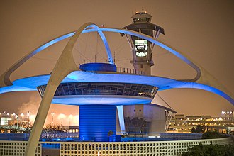
Los Angeles
City / town · 86 listings

Universal City
City / town

Sacramento
City / town · 91 listings

West
Neighborhood · 52 listings

Sonoma
City / town · 66 listings

Santa Cruz
City / town · 73 listings

Menlo Park
City / town · 75 listings

Northwest
Neighborhood · 58 listings

San Leandro
City / town · 67 listings

Fort Bragg
City / town · 43 listings

Pasadena
City / town · 64 listings

San Luis Obispo
City / town · 51 listings

Santa Rosa
City / town · 48 listings

Fresno
City / town · 70 listings

Palm Springs
City / town · 58 listings

Mountain View
City / town · 55 listings

Los Angeles International Airport
Airport · 57 listings

Chula Vista
City / town · 43 listings

Julian
City / town · 70 listings

La Jolla
Neighborhood · 45 listings

Joshua Tree National Park
Park · 41 listings

Carmel
City / town · 48 listings

Irvine
City / town · 62 listings

Palmdale
City / town · 59 listings

Wilshire
Neighborhood · 40 listings

Riverside
City / town · 37 listings

Palo Alto
City / town · 53 listings

Mission Beach-Pacific Beach
Neighborhood · 43 listings

Fremont
City / town · 45 listings

San Rafael
City / town · 27 listings

Newport Beach
City / town · 53 listings
Anaheim
City / town · 43 listings

Napa
City / town · 52 listings

Santa Clara
City / town · 40 listings

South
Neighborhood · 20 listings

Marina del Rey
City / town · 52 listings

Pittsburg
City / town · 40 listings

Martinez
City / town · 27 listings

Claremont
City / town · 38 listings

Magic Mountain
Park · 47 listings

Carmel Point
City / town · 37 listings

Emeryville
City / town · 21 listings

Lompoc
City / town · 33 listings

Avalon
City / town · 47 listings

Laguna Beach
City / town · 47 listings

Redding
City / town · 44 listings

Hayward
City / town · 37 listings

Idyllwild
City / town · 46 listings

West Hollywood
City / town · 40 listings

Costa Mesa
City / town · 36 listings

Half Moon Bay
City / town · 30 listings

Willits
City / town · 39 listings

Barstow
City / town · 29 listings

Beverly Hills
City / town · 32 listings

Healdsburg
City / town · 38 listings

Santa Ana
City / town · 38 listings

Lava Beds National Monument
Park · 34 listings

Oceanside
City / town · 34 listings

Richmond
City / town · 22 listings

Whittier
City / town · 31 listings

Windsor
City / town · 34 listings

Arcata
City / town · 39 listings

Burlingame
City / town · 39 listings

Dunsmuir
City / town · 39 listings

Sequoia and Kings Canyon National Parks
Park · 39 listings

Simi Valley
City / town · 36 listings

Burbank
City / town · 32 listings

San Clemente
City / town · 40 listings

Coronado
City / town · 30 listings

Carlsbad
City / town · 32 listings

Huntington Beach
City / town · 38 listings

Mammoth Lakes
City / town · 32 listings

Petaluma
City / town · 41 listings

Encinitas
City / town · 34 listings

Watsonville
City / town · 40 listings
Bakersfield
City / town · 39 listings

Novato
City / town · 24 listings

Salinas
City / town · 36 listings

Big Bear Lake
City / town · 29 listings

Calistoga
City / town · 38 listings

Point Loma-Ocean Beach
Neighborhood · 25 listings

Fullerton
City / town · 27 listings

Paso Robles
City / town · 33 listings

North
Neighborhood · 24 listings

Sausalito
City / town · 33 listings

Antioch
City / town · 32 listings

El Centro
City / town · 29 listings

Guerneville
City / town · 23 listings

Venice
City / town · 29 listings

La Mirada
City / town · 31 listings

Palm Desert
City / town · 25 listings

Mid-City
Neighborhood · 25 listings

Glendale
City / town · 27 listings

Mendocino
City / town · 24 listings

Morro Bay
City / town · 24 listings

Pinnacles National Park
Park · 18 listings

Buena Park
City / town · 23 listings

Davis
City / town · 23 listings

Lake Tahoe
Region · 20 listings

Manhattan Beach
City / town · 23 listings

Mojave National Preserve
Park · 17 listings

San Pedro
City / town · 29 listings

Solvang
City / town · 26 listings

Vallejo
City / town · 26 listings

Chico
City / town · 28 listings

Inglewood
City / town · 22 listings

Millbrae
City / town · 19 listings

San Juan Capistrano
City / town · 19 listings

South Lake Tahoe
City / town · 22 listings

South Valley
City / town · 16 listings

Bodega Bay
City / town · 24 listings

Eureka
City / town · 24 listings

Weed
City / town · 18 listings

Santa Monica Mountains National Recreation Area
Park · 21 listings

Palos Verdes
Rural area · 20 listings

Rohnert Park
City / town · 26 listings

San Bernardino
City / town · 26 listings

Larkspur and Corte Madera
City / town · 11 listings

Gilroy
City / town · 25 listings

Oxnard
City / town · 28 listings

Red Bluff
City / town · 25 listings

Sunnyvale
City / town · 28 listings

Tracy
City / town · 25 listings

Escondido
City / town · 21 listings

Grass Valley
City / town · 18 listings

Lancaster
City / town · 27 listings

Lassen Volcanic National Park
Park · 21 listings

Modesto
City / town · 27 listings

Mojave
City / town · 12 listings

Pacific Grove
City / town · 18 listings

Redwood City
City / town · 24 listings

Ridgecrest
City / town · 24 listings
Tahoe City
City / town · 27 listings

Torrance
City / town · 21 listings

Cerritos
City / town · 17 listings

Morgan Hill
City / town · 26 listings
Sebastopol
City / town · 26 listings

Tiburon
City / town · 14 listings

St. Helena
City / town · 19 listings

Van Nuys
City / town · 22 listings
Bay Area
Region

Malibu
City / town · 21 listings

San Mateo
City / town · 21 listings

Truckee
City / town · 18 listings
Woodland
City / town · 24 listings

Yosemite West
Park · 6 listings

Sunol
City / town · 15 listings

Capitola
City / town · 20 listings

Cupertino
City / town · 20 listings

Danville
City / town · 11 listings

Oakhurst
City / town · 23 listings

Redwood National Park
Park · 20 listings

San Ysidro
Neighborhood · 20 listings

Upland
City / town · 20 listings

Benicia
City / town · 16 listings

Downey
City / town · 19 listings

Eastside
Neighborhood · 13 listings

Mill Valley
City / town · 22 listings

Mission Viejo
City / town · 22 listings

Redondo Beach
City / town · 22 listings

Santa Clarita
City / town · 22 listings

Auburn
City / town · 18 listings
Campbell
City / town · 21 listings

Desert Hot Springs
City / town · 18 listings

Twentynine Palms
City / town · 18 listings

Yountville
City / town · 21 listings

Kenwood
City / town · 15 listings

Arcadia
City / town · 14 listings

Dana Point
City / town · 17 listings
Merced
City / town · 20 listings
Occidental
City / town · 20 listings

Pismo Beach
City / town · 17 listings
Three Rivers
City / town · 20 listings

Westminster
City / town · 14 listings

Seal Beach
City / town · 14 listings
North Valley
City / town · 20 listings

Aptos
City / town · 13 listings

Avila Beach
City / town · 13 listings

Bishop
City / town · 19 listings

Del Mar
City / town · 13 listings

Mariposa
City / town · 13 listings

Blythe
City / town · 15 listings

El Segundo
City / town · 15 listings

Garden Grove
City / town · 15 listings

Indio
City / town · 15 listings

Lake Forest
City / town · 15 listings

Los Alamitos
City / town · 12 listings

San Bruno
City / town · 12 listings

San Simeon
City / town · 9 listings

Slab City
City / town · 9 listings

Mount Diablo State Park
Park · 9 listings

Clearlake
City / town · 11 listings

Cypress
City / town · 14 listings

Delano
City / town · 14 listings

Dublin
City / town · 11 listings

El Cerrito
City / town · 11 listings
Newark
City / town · 17 listings

Studio City
City / town · 14 listings

Thousand Oaks
City / town · 17 listings

Vacaville
City / town · 17 listings

Westchester
City / town · 17 listings

Walnut Grove
City / town · 11 listings

Albany
City / town · 13 listings

Cambria
City / town · 10 listings

Catalina Island
Region · 13 listings

Compton
City / town · 13 listings

North Hollywood
City / town · 10 listings

Orange
City / town · 16 listings

Pacific Palisades
City / town · 10 listings

Pinecrest
City / town · 13 listings

Pleasant Hill
City / town · 16 listings
Santa Maria
City / town · 16 listings

Carrizo Plain National Monument
Park · 6 listings

Folsom
City / town · 12 listings
Lakewood
City / town · 15 listings

Mono Lake
Park · 6 listings
Monterey County
Region · 3 listings

Roseville
City / town · 15 listings

Union City
City / town · 9 listings
Brentwood
City / town · 14 listings

Fairfax
City / town · 14 listings
King City
City / town · 14 listings

Moss Landing
City / town · 11 listings

South San Francisco
City / town · 11 listings
Tahoe Vista
City / town · 14 listings
Ukiah
City / town · 14 listings

Angel Island
Park · 5 listings

Agoura Hills
City / town · 10 listings

Bear Valley
City / town · 10 listings

Chatsworth
City / town · 10 listings

Forestville
City / town · 10 listings
Jamestown
City / town · 13 listings

Pinole
City / town · 10 listings

San Ramon
City / town · 10 listings
Sherman Oaks
City / town · 13 listings

Moss Beach
City / town · 4 listings

Lick Observatory
City / town · 7 listings

California City
City / town · 7 listings

Angeles National Forest
Park · 12 listings

Artesia
City / town · 12 listings

Big Basin Redwoods State Park
Park
Central Coast
Region
Exeter
City / town · 12 listings

Hermosa Beach
City / town · 12 listings

Orange County
Region
Rutherford
City / town · 12 listings

San Marcos
City / town · 9 listings

Outer East Bay
Region

Amboy
City / town · 2 listings
Anderson
City / town · 11 listings

Ojai
City / town · 11 listings
Pico Rivera
City / town · 11 listings

Baker
City / town · 7 listings

Buttonwillow
City / town · 7 listings

Fallbrook
City / town · 7 listings

Napa Valley
Region · 1 listings
Norwalk
City / town · 10 listings
Pixley
City / town · 7 listings

Valencia
City / town · 10 listings

Volcano
City / town · 7 listings
Ludlow
City / town · 7 listings
Inner East Bay
Region · 1 listings

Arroyo Grande
City / town · 9 listings

Calabasas
City / town · 6 listings

Camarillo
City / town · 9 listings

Carson
City / town · 9 listings

Crescent City
City / town · 9 listings

Maricopa
City / town · 6 listings
Monrovia
City / town · 9 listings

Mount Whitney
Park · 3 listings

Pescadero
City / town · 22 listings

San Diego County
Region
Scotts Valley
City / town · 9 listings

Yreka
City / town · 9 listings

Fort Ross
Park · 5 listings

Foster City
City / town · 8 listings

Los Osos
City / town · 8 listings

Madera
City / town · 8 listings
Seaside
City / town · 8 listings

Stanton
City / town · 5 listings
Sierra City
City / town · 8 listings
Cottonwood
City / town · 7 listings

Gold River
City / town · 4 listings
McCloud
City / town · 7 listings

Santa Barbara County
Region · 4 listings

Topanga
City / town · 7 listings

Anaheim Hills
City / town · 6 listings
Castro Valley
City / town · 6 listings
Coarsegold
City / town · 6 listings

East Bay
Region
Homewood
City / town · 6 listings

Quincy
City / town · 43 listings
Southern California
Region · 6 listings

Inland
Region · 2 listings

Lafayette
City / town · 5 listings

Marin County
Region · 2 listings

Playa del Rey
City / town · 5 listings

Bolinas
City / town · 4 listings

Temecula
City / town · 38 listings

Beach Cities
Region

Castaic
City / town · 3 listings

El Portal
City / town · 3 listings

Gateway Cities
Region

North County
Region

San Gabriel Valley
Region

Santa Clarita Valley
Region

South Bay
Region

South Bay
Region

Westside
Region
Aliso Viejo
City / town · 5 listings

Antelope Valley
Region · 2 listings
Stinson Beach
City / town · 5 listings

Ventura County
Region · 1 listings

San Fernando Valley
Region

Golden Gate National Recreation Area
Place · 13 listings

Sonoma Valley
Place · 23 listings

Angels Camp
City / town · 25 listings

Los Altos
City / town · 28 listings

Los Gatos
City / town · 22 listings

Glen Ellen
City / town · 30 listings
Diablo Range
Place

Bernal Heights
Neighborhood · 23 listings
Manteca
City / town · 30 listings

Channel Islands National Park
Place · 9 listings

Nevada City
City / town · 18 listings

Imperial Beach
City / town · 11 listings

Redlands
City / town · 23 listings

Reedley
City / town · 26 listings

Stockton
City / town · 26 listings

Goleta
City / town · 21 listings
La Quinta
City / town · 23 listings

Fairfield
City / town · 22 listings

National City
City / town · 13 listings

Ontario
City / town · 19 listings
Chester
City / town · 21 listings

Borrego Springs
City / town · 18 listings

Buellton
City / town · 20 listings

El Cajon
City / town · 17 listings

Elk Grove
City / town · 17 listings

Placerville
City / town · 17 listings
Visalia
City / town · 20 listings

Rancho Cordova
City / town · 13 listings

Trinidad
City / town · 10 listings
Boonville
City / town · 18 listings

Joshua Tree
City / town · 12 listings

Milpitas
City / town · 18 listings

Sonora
City / town · 9 listings
Weaverville
City / town · 18 listings

Harbor
Neighborhood · 9 listings

Alturas
City / town · 8 listings

Murphys
City / town · 14 listings

Rocklin
City / town · 14 listings

Stateline
City / town · 14 listings

Woodside
City / town · 8 listings

Anza-Borrego Desert State Park
Park · 1 listings
Chino Hills
City / town · 13 listings

Fountain Valley
City / town · 13 listings

Needles
City / town · 13 listings

Solana Beach
City / town · 13 listings

Vista
City / town · 13 listings

Belmont
City / town · 9 listings
Clovis
City / town · 15 listings

Mount Shasta
City / town · 6 listings

Pacifica
City / town · 12 listings

Olympic Valley
City / town · 9 listings

Taft
City / town · 12 listings
Tulare
City / town · 15 listings

El Verano
City / town · 12 listings

Felton
City / town · 8 listings

Laguna Niguel
City / town · 11 listings

Los Olivos
City / town · 11 listings

Orinda
City / town · 8 listings

Rancho Mirage
City / town · 8 listings

Salton Sea
Place · 2 listings

Sequoia National Forest
Park · 11 listings

Independence
City / town · 7 listings
Placentia
City / town · 13 listings
Pomona
City / town · 13 listings

Shasta Lake
City / town · 4 listings

Victorville
City / town · 10 listings

Bridgeport
City / town · 6 listings

Cloverdale
City / town · 12 listings

Fall River Mills
City / town · 6 listings

Hawthorne
City / town · 9 listings

Marina
City / town · 9 listings

Mendocino County
Region · 3 listings
Monterey Park
City / town · 12 listings

Rosamond
City / town · 9 listings
San Joaquin Valley
Region · 9 listings

Sutter Creek
City / town · 9 listings

Tehachapi
City / town · 9 listings

White Mountains
Park · 6 listings

The Grapevine
City / town · 9 listings

Henry W. Coe State Park
Park · 6 listings
Bellflower
City / town · 11 listings

Burney
City / town · 8 listings

Chino
City / town · 8 listings

City of Commerce
City / town · 5 listings

Devils Postpile National Monument
Park · 5 listings

Fish Camp
City / town · 8 listings

Humboldt County
Region · 11 listings

Incline Village
City / town · 8 listings

Inland Empire
Place · 5 listings
Lakehead
City / town · 11 listings

Loma Linda
City / town · 5 listings

Lone Pine
City / town · 11 listings

Point Arena
City / town · 5 listings

Rio Vista
City / town · 8 listings

Saratoga
City / town · 8 listings

Soledad
City / town · 8 listings

Tustin
City / town · 8 listings
Carpinteria
City / town · 10 listings
La Mesa
City / town · 10 listings

Lathrop
City / town · 10 listings

Lee Vining
City / town · 7 listings
Marin Headlands
Rural area · 13 listings

Mi-Wuk Village
City / town · 7 listings

Peninsula
Region · 7 listings
Rancho Cucamonga
City / town · 10 listings

Willows
City / town · 7 listings

Yorba Linda
City / town · 4 listings

Hacienda Heights
City / town · 7 listings

Winters
City / town · 7 listings

Boulder Creek
City / town · 6 listings

Brea
City / town · 6 listings

Corona
City / town · 9 listings

Daly City
City / town · 9 listings
Desert
Region
Gardena
City / town · 9 listings

Groveland
City / town · 6 listings

Jackson
City / town · 6 listings
Lake Arrowhead
City / town · 9 listings

Santa Ynez
City / town · 6 listings
Sierra Nevada
Region

West Sacramento
City / town · 6 listings
California Wine Country
Place

Cachuma Lake Recreation Area
Park

Tri-Valley
Place
Perris
City / town · 9 listings
Alhambra
City / town · 11 listings

Citrus Heights
City / town · 8 listings

Hanford
City / town · 5 listings
Hemet
City / town · 8 listings
Isleton
City / town · 5 listings

Kern County
Region · 2 listings
Klamath
City / town · 8 listings

Los Altos Hills
City / town · 2 listings

McKinleyville
City / town · 5 listings

Oakdale
City / town · 5 listings

Oceano
City / town · 5 listings

San Dimas
City / town · 5 listings

Trinity County
Region · 8 listings

Williams
City / town · 5 listings

Yuba City
City / town · 5 listings

Montecito
City / town · 5 listings

San Juan Bautista
City / town · 2 listings
Yucca Valley
City / town · 8 listings

Mare Island
Neighborhood · 5 listings

Adelanto
City / town · 4 listings

Atascadero
City / town · 7 listings

Clayton
City / town · 4 listings
Dixon
City / town · 7 listings
Etna
City / town · 7 listings

Firebaugh
City / town · 7 listings
Fortuna
City / town · 7 listings

Hollister
City / town · 7 listings
Jenner
City / town · 7 listings
Lake Elsinore
City / town · 7 listings
Oakley
City / town · 7 listings

Rialto
City / town · 4 listings

Santa Nella
City / town · 4 listings

Arnold
City / town · 4 listings

Campo
City / town · 4 listings

Calexico
City / town · 6 listings

Carmel Valley
City / town · 3 listings

Cathedral City
City / town · 3 listings

Coulterville
City / town · 3 listings

El Monte
City / town · 3 listings
Gold Country
Region
Kingsburg
City / town · 6 listings

La Cañada Flintridge
City / town · 3 listings

Lodi
City / town · 6 listings
Los Banos
City / town · 6 listings

Nipomo
City / town · 3 listings

Palo Cedro
City / town · 3 listings

Jurupa Valley
City / town · 3 listings
Salida
City / town · 6 listings
San Carlos
City / town · 6 listings
San Luis Obispo County
Region

Two Harbors
City / town · 6 listings

West Covina
City / town · 3 listings

La Habra
City / town · 3 listings

Banning
City / town · 2 listings

Corning
City / town · 5 listings

French Gulch
City / town · 2 listings

Grover Beach
City / town · 5 listings
Gualala
City / town · 5 listings
Keene
City / town · 2 listings

Kernville
City / town · 5 listings
Lakeport
City / town · 5 listings

Marysville
City / town · 5 listings
McArthur
City / town · 5 listings

Ripon
City / town · 2 listings

San Gabriel
City / town · 5 listings

San Marino
City / town · 2 listings
Shasta Cascades
Region · 5 listings

Sonoma County
Region · 2 listings
Susanville
City / town · 5 listings
Turlock
City / town · 5 listings
Wasco
City / town · 5 listings

Galt
City / town · 2 listings

Brisbane
City / town · 4 listings
Cecilville
City / town · 4 listings
Chowchilla
City / town · 4 listings

Coachella
City / town · 1 listings

Colma
City / town · 4 listings
Colton
City / town · 4 listings

Death Valley Junction
City / town · 1 listings
Diamond Bar
City / town · 4 listings
Dinuba
City / town · 4 listings
Dorris
City / town · 4 listings
Ferndale
City / town · 4 listings

Geyserville
City / town · 4 listings
Middletown
City / town · 4 listings
Oakville
City / town · 4 listings
Poway
City / town · 4 listings

Riverside County
Region · 1 listings

Rock Creek Lake
Park · 1 listings
Rosemead
City / town · 4 listings
San Anselmo
City / town · 4 listings
Santa Paula
City / town · 4 listings
South Pasadena
City / town · 4 listings

Norco
City / town · 1 listings

Plymouth
City / town · 4 listings

Armstrong Redwoods State Natural Reserve
Park
Atwater
City / town · 3 listings
Beaumont
City / town · 3 listings

Bliss State Park
Park

Brawley
City / town · 3 listings

Channel Islands
Place
Coalinga
City / town · 3 listings

Eastern Sierra
Region

Glenn County
Region

Great Basin
Place
Hornbrook
City / town · 3 listings
Indian Wells
City / town · 3 listings
Junction City
City / town · 3 listings
Kelseyville
City / town · 3 listings
Kettleman City
City / town · 3 listings
Laguna Hills
City / town · 3 listings
Lemoore
City / town · 3 listings

McFarland
City / town · 3 listings
McKittrick
City / town · 3 listings

Mojave Desert
Place
Moraga
City / town · 3 listings
Moreno Valley
City / town · 3 listings
Porterville
City / town · 3 listings

Ramona
City / town
Sacramento Valley
Region

San Bernardino County
Region
San Miguel
City / town · 3 listings
Shingletown
City / town · 3 listings

Silicon Valley
Place
Loyalton
City / town · 3 listings
Monte Rio
City / town · 3 listings
Coloma
City / town · 3 listings

Colfax
City / town · 3 listings

Alpine County
Region · 2 listings

Big Pine
City / town · 2 listings
Blue Lake
City / town · 2 listings
Covina
City / town · 2 listings
Fontana
City / town · 2 listings
Garberville
City / town · 2 listings
Guadalupe
City / town · 2 listings
Hayfork
City / town · 2 listings
Hesperia
City / town · 2 listings
Klamath River
City / town · 2 listings
La Verne
City / town · 2 listings
Lawndale
City / town · 2 listings

Lost Hills
City / town · 2 listings
Montgomery Creek
City / town · 2 listings

Olancha-Cartago
City / town · 2 listings
Santa Fe Springs
City / town · 2 listings
Scotia
City / town · 2 listings
Selma
City / town · 2 listings
Westley
City / town · 2 listings
Huntington Park
City / town · 2 listings
Shasta
City / town · 2 listings
Fulton
City / town · 2 listings

Baldwin Park
City / town · 1 listings

Bombay Beach
City / town · 1 listings

Calaveras County
Region · 1 listings

Calipatria
City / town · 1 listings
Callahan
City / town · 1 listings

Cotati
City / town · 1 listings
El Dorado Hills
City / town · 1 listings
Fillmore
City / town · 1 listings
Gustine
City / town · 1 listings
Hilmar
City / town · 1 listings

Imperial County
Region · 1 listings
Inyokern
City / town · 1 listings

Lake County
Region · 1 listings
Mad River
City / town · 1 listings
McClellan Park
City / town · 1 listings

Merced County
Region · 1 listings
Mill Creek
City / town · 1 listings

Mono County
Region · 1 listings
North Coast
Region · 1 listings
North Highlands
City / town · 1 listings
Parker Dam
City / town · 1 listings
Patterson
City / town · 1 listings
Pollock Pines
City / town · 1 listings
Port Hueneme
City / town · 1 listings
Portola Valley
City / town · 1 listings

Sacramento County
Region · 1 listings

Santa Cruz County
Region · 1 listings

Sea Ranch
City / town · 1 listings

Shaver Lake
City / town · 1 listings

Shoshone
City / town · 1 listings
Twain Harte
City / town · 1 listings

Santa Clara Valley
Region · 1 listings
Lynwood
City / town · 1 listings

Mendocino National Forest
Park · 1 listings
Salton City
City / town · 1 listings
Suisun City
City / town · 1 listings
Albion
City / town · 3 listings

Amador County
Region
Apple Valley
City / town · 3 listings
Big Bend
City / town

Butte County
Region

Cleveland National Forest
Park
Columbia
City / town

Colusa County
Region

Del Norte County
Region

El Dorado County
Region

Emerald Bay State Park
Park

Fresno County
Region

Inland Cities
Region

Inyo County
Region

Kings County
Region
Kirkwood
City / town

Lassen County
Region

Macdoel
City / town

Madera County
Region

Mariposa County
Region

Modoc County
Region

Monterey Bay
Place

Nevada County
Region

Owens Valley
Place

Placer County
Region

Plumas County
Region
Round Mountain
City / town

San Benito County
Region

San Joaquin County
Region
Diving in California
Dive site

Shasta County
Region

Sierra County
Region

Siskiyou County
Region

Solano County
Region

South Bay
Region

Stanislaus County
Region

Sutter County
Region

Tehama County
Region

Tulare County
Region

Tuolumne County
Region

Yolo County
Region

Yuba County
Region

West Coast
Place
Imperial
City / town · 2 listings
Niland
City / town · 1 listings
Whiskeytown National Recreation Area
Park · 1 listings
North Bay
Region
Nearby
Shaver Lake
City / town · 1 listings · 12 mi away
Clovis
City / town · 15 listings · 16 mi away
Coarsegold
City / town · 6 listings · 21 mi away
Fresno
City / town · 70 listings · 22 mi away
Oakhurst
City / town · 23 listings · 24 mi away
Reedley
City / town · 26 listings · 28 mi away
Selma
City / town · 2 listings · 30 mi away
Madera
City / town · 8 listings · 31 mi away
My experience
Write about your trip here. Notes save automatically in this browser as you type; back them up from My journal.