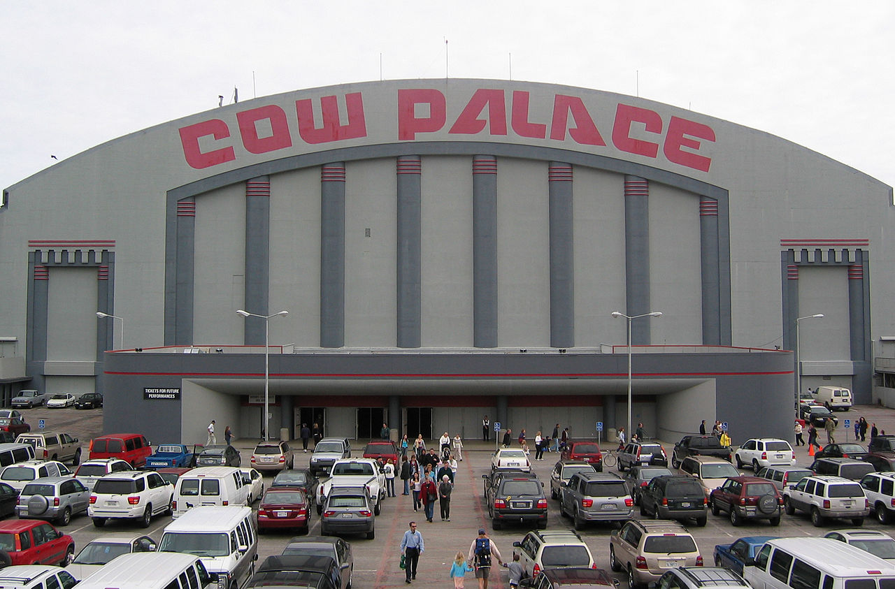
Overview
Southeast San Francisco is made up of several mostly residential neighborhoods of San Francisco bounded on the north and west by I-280, the 101 highway, and 16th Street, the east by the San Francisco Bay, and on the south by the city limits.
12 sights · 1 things to do · 6 places to eat · 3 bars & cafés
Updated from Wikivoyage on 1 October 2026 · Something wrong or missing? Improve it on Wikivoyage
Best things about Southeast
Bayview Opera House
A wooden structure built in 1888 and now used as a community meeting center.
Candlestick Point State Recreation Area
Right on the Bay is this actually very nice and undervisited park. It's very green, actually has functioning benches and BBQ pits, and a small fishing pier. You are also likely to spot windsurfers who come to this windy …
McLaren Park
At 317 acres (128 hectares), this is the second largest park in San Francisco, and is located smack dab in Visitacion Valley. It has been cleaned up, but this park is still under used. With rolling hills and views galore…
San Francisco Naval Shipyard
If you are feeling adventurous, try visiting the abandoned shipyard at Hunter's Point.
Vermont Street
The (nearly) twistiest street in America, a less known version of Lombard Street between Leavenworth and Hyde in Russian Hill.
Cayuga Playground
A park with many delightful, ideosyncratic hand-carved sculptures by a long-time park gardener. A good place to bring and enjoy take-out from eateries in the vicinity of Geneva Avenue and Mission Street. Well off the typ…
Plan your trip
Best time to visit & weather
Most comfortable: Mar–Nov. Summer highs reach about 72°F; winter lows dip to about 44°F. Wettest: Dec and Jan. (climate data from nearby San Francisco)
Blue bars: average daily high and low (°F). Purple columns: average monthly rain and melted snow (inches).
Getting there
- From you: to see whether to drive or fly, and how long it takes.
- SFO San Francisco International Airport, San Francisco — 8 mi away (major hub). Directions
- OAK Oakland San Francisco Bay Airport, Oakland — 10 mi away (major hub). Directions
The MUNI Metro serves several neighborhoods of Southeast San Francisco. The -Third line light rail runs the length of 3rd Street from Downtown through Potrero Hill and Bayview-Hunters Point to its southern terminus at Bay Shore Blvd and Sunnydale Avenue in Visitacion Valley. On the other side of Southeast San Francisco, the , and lines meet up at the Balboa Park BART station near Ingleside. The and lines run west through Ingleside, while the line runs north through Noe Valley and the Castro.
Full “Get in” guide ↓Budget & where to stay
- Typical meal: about $20 per person at listed restaurants.
See the Sleep guide ↓ for places to stay.
Sample 3-day itinerary
Day 1
- Morning Bayview Opera House, Speakeasy Ales & Lagers Brewery, The EcoCenter at Heron's Head Park
- Lunch Hard Knox Cafe
- Afternoon Heron's Head Park, Hunter's Point Springs-Albion Brewery
- Dinner Marcella's Lasagneria
- Evening Farley's Coffee and Newsstand
Day 2
- Morning McLaren Park, Cow Palace
- Lunch 7-Mile House
- Afternoon Cayuga Playground
- Dinner Old Clam House
- Evening Blooms Saloon
Day 3
- Morning Anchor Steam Brewery
- Lunch Goat Hill Pizza
- Afternoon Vermont Street
- Dinner Plow
- Evening Bottom of the Hill
Stops are grouped by area so each day needs little backtracking. Check opening hours before you go.
Food for you
Cuisine (tap to filter)
What to ask about, for your diet
Diet labels come from each listing's description and cuisine; “likely” means the cuisine usually has good choices, not a promise. Check with the restaurant. Open the food finder
Photos


Map
Every listing with a location. Tap a pin for its Google Maps link.
Understand
Bayview-Hunter's Point is bounded roughly by Cesar Chavez to the north, the 101 freeway to the west, and the San Francisco Bay to the east. When the Navy closed the Naval Shipyard (the site of the first dry-dock on the West Coast and a major population draw), it also cut the jobs that the Shipyard provided. As jobs left, crime rose, and Hunters Point is now one of the worst neighborhoods of the city. It is however turning around slowly, and people who live there say it's not as bad as it was 10 years ago. New apartments are being built and the Muni Metro (public transit) has been extended.
Dogpatch is a diverse neighborhood on the eastern edge of Potrero Hill, recognized as a historic district by the city in 2003.
The Excelsior is part of the area known as the Outer Mission. The district is a mostly residential and filled with working-class neighborhoods. Mission and connecting streets have a variety of Asian and Latinx eateries, bakeries, and markets.
Portolá is a mostly residential district bounded by 101, 280, University Ave and Mansell St. San Bruno Avenue has many Asian and a few Latinx eateries, bakeries, and markets.
Potrero Hill is a district located east of the Mission District and south of SoMa. It is bordered on the north by 16th Street, on the west by Potrero Avenue (U.S. Route 101), and on the south by Cesar Chavez Street.
Visitacion Valley is a district bordered roughly by John McLaren Park to the west, Mansell Boulevard to the north, Bayview Hill and Candlestick Cove to the east, and the San Francisco/San Mateo County line to the south.
Get in
The MUNI Metro serves several neighborhoods of Southeast San Francisco. The -Third line light rail runs the length of 3rd Street from Downtown through Potrero Hill and Bayview-Hunters Point to its southern terminus at Bay Shore Blvd and Sunnydale Avenue in Visitacion Valley. On the other side of Southeast San Francisco, the , and lines meet up at the Balboa Park BART station near Ingleside. The and lines run west through Ingleside, while the line runs north through Noe Valley and the Castro.
BART, the regional metro system, stops at the Balboa Park station as well as the Glen Park station (also serviced by MUNI Metro J line) just to the north, before continuing on through the Mission district to Downtown and across the bay. Caltrain, a commuter rail running south from Downtown to San Jose, has two stops in Southeast San Francisco: the 22nd Street station on Pennsylvania and 22nd Streets, and the Bayshore station on Tunnel Avenue south of Bayshore Blvd, near the end of the MUNI Metro line.
The area is also serviced by the 8/8AX/8BX-Bayshore, 9/9R-San Bruno, 14/14R-Mission, 19-Polk, 22-Fillmore, 23-Monterey, 24-Divisadero, 29-Sunset, 43-Masonic, 44-O'Shaughnessy, 48-Quintara/24th Street, 49-Mission/Van Ness, 52-Excelsior, 54-Felton and 56-Rutland MUNI bus lines.
By car, I-280 and the 101 Highway provide easy freeway access to the area.
See
See Bayview Hill Park
Overlooking Candlestick Park, this park has great panoramic views of the bay, however it's not one of San Francisco's better maintained parks.
See Heron's Head Park
A 24-acre (10-hectare) restored wetland at the base of the Hunters Point Power Plant.
See McLaren Park
At 317 acres (128 hectares), this is the second largest park in San Francisco, and is located smack dab in Visitacion Valley. It has been cleaned up, but this park is still under used. With rolling hills and views galore, this is the best place in the city to get away from it. If you have a dog, bring it to the reservoir on Shelley Drive where there is a large off-leash area where your pet can romp in the fields or swim in the water. There is an amphitheater, a duck pond, multiple playgrounds, some great hiking trails, and a few tennis courts.
See San Francisco Naval Shipyard
If you are feeling adventurous, try visiting the abandoned shipyard at Hunter's Point.
See Vermont Street
The (nearly) twistiest street in America, a less known version of Lombard Street between Leavenworth and Hyde in Russian Hill.
See Cayuga Playground (Cayuga Park)
A park with many delightful, ideosyncratic hand-carved sculptures by a long-time park gardener. A good place to bring and enjoy take-out from eateries in the vicinity of Geneva Avenue and Mission Street. Well off the typical tourist path but quite moving.
Do
Buy
Shop Bayshore Farmers Market
Eat
Eat Old Clam House
Established in 1861. Start your meal with clam broth and sourdough bread.
Eat Hard Knox Cafe
Casual soul food; oxtail, ribs, fried chicken, etc.
Eat 7-Mile House
The 7-Mile House is a historic landmark and a great place to get some food. During the days of the gold rush, the 7-mile house served as a resting post for horse coaches travelling from San Francisco (Embarcadero) to San Jose. This was a place to rest your horses, get some beer and share stories of finding gold. Today, the place boasts an authentic gold rush decor, great beer and burgers and live music most days of the week.
Eat Goat Hill Pizza
Great family pizza place.
Eat Plow
popular place for brunch
Eat Marcella's Lasagneria
Seven kinds of lasagna, plus salads and other pasta dishes. Lunch only. Daily special includes smaller serving with either a small green salad or a cup of soup. Takeout option is available hot or cold, in case you want to pick up now and heat up later. Call a day or two in advance if you want to order a whole pan of lasagna for take out (about $80 for 8 people).
Drink
Drink Bottom of the Hill
Chosen by Rolling Stone magazine (RS 813) as "the best place to hear live music in San Francisco", the Bottom of the Hill presents some of the finest original artists, seven nights a week. It has a full bar and a kitchen and also features a nice patio area to escape the crowd and have a smoke. Scheduled to close for good at the end of 2026, so this year (planned to include farewell shows with bands from the club's history) may be your last chance to experience it.
Drink Farley's Coffee and Newsstand
An institution in Potrero Hill since 1989. Roger (the owner) is a conscientious-objector to cafe wi-fi, so don't expect any. But do expect sociable strangers, shelves-full of community sketchbooks, a pile of tattered old board-games, the best newsstand outside of Civic Center, old Hell's Angels guys socializing with Armani clad architects, delicious coffee drinks, a toy bin for the kids, and dog-friendly folks outside to pet your dog while you're inside.
Drink Blooms Saloon
One of the few remaining true blue-collar watering holes around, this is very much a neighborhood bar and a great place to go to watch baseball and football games. No around-the-shoulder cuffed-sweaters, khaki pants, or tassle-loafer wearin' folks in this joint, but lots of friendly folks, and during Giants or 49ers games, cheers and boos can be heard from a good block away. One of the best views in the city is from out the back porch, which regrettably is now only open during the day. Not a quiet bar, but the back seating area is a good place to meet friends for a 'mellow' beer and chit-chat after dinner or work. All of the sports watching and local gossip takes place up towards the front. Friendly staff; no airheads allowed.
Sleep
There are few lodging opportunities in this area, and those that are here are often run-down motels along the main streets which unfortunately have a reputation for attracting drug dealers, crime, and general uncleanliness of the motels themselves; not to mention that they are far from the city's main attractions. There are some very affordable and generally nicer accommodations closer to the tourist neighborhoods and just south in Daly City.
Nearby

Brisbane
City / town · 4 listings · 3 mi away

Colma
City / town · 4 listings · 4 mi away

Daly City
City / town · 9 listings · 5 mi away

South San Francisco
City / town · 11 listings · 5 mi away

San Bruno
City / town · 12 listings · 7 mi away

Alameda
City / town · 51 listings · 7 mi away

Pacifica
City / town · 12 listings · 9 mi away

Millbrae
City / town · 19 listings · 9 mi away
My experience
Write about your trip here. Notes save automatically in this browser as you type; back them up from My journal.