Overview
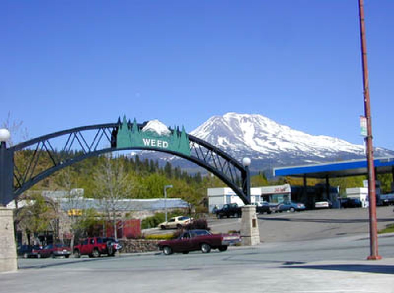
Weed is a city of 2,700 people (2019) in Siskiyou County in the Shasta Cascades region of California, at the western foot of Mount Shasta.
3 sights · 7 things to do · 1 places to eat · 3 places to stay
Updated from Wikivoyage on 1 October 2026 · Something wrong or missing? Improve it on Wikivoyage
Best things about Weed

Mt Shasta Brewing Co.

Mount Shasta Ski Park
Weed Lumber Museum
Veterans Living Memorial Sculpture Garden
Volcanic Legacy Scenic Byway
A scenic road from volcano to volcano that passes through Weed!
Cedar Lanes
Bowling, cafe, bar at night, and take and bake pizza.
Plan your trip
Best time to visit & weather
Most comfortable: May–Oct. Summer highs reach about 86°F; winter lows dip to about 22°F. Wettest: Feb and Mar. (climate data from nearby Lava Beds National Monument)
Blue bars: average daily high and low (°F). Purple columns: average monthly rain and melted snow (inches).
Getting there
- From you: to see whether to drive or fly, and how long it takes.
- RDD Redding Municipal Airport, Redding — 63 mi away. Directions
- MFR Rogue Valley International-Medford Airport, Medford — 70 mi away. Directions
- RNO Reno Tahoe International Airport, Reno — 191 mi away (major hub). Directions
* Portland, OR (via I-5 for 350 mi): 5.5 hours * Medford, OR (via I-5 for 79 mi): 1.5 hour * Redding, CA (via I-5) for 70 mi): 1 hour 15 min. * Sacramento, CA (via I-5) for 229 mi): 3.5 hours * San Francisco, CA (via I-5, 505 & I-80) for 284 mi): 5 hours
Full “Get in” guide ↓Budget & where to stay
No prices are listed for this place yet. See the Sleep guide ↓ for options.
Sample 2-day itinerary
Day 1
- Morning Weed Lumber Museum, Cedar Lanes, Volcanic Legacy Scenic Byway
- Lunch Pizza Factory
- Afternoon Weed Golf Club, Mt Shasta Brewing Co.
Day 2
- Morning Veterans Living Memorial Sculpture Garden, Lake Shastina Golf Resort
- Afternoon Weed Skatepark, Pneuma Retreat Center
Stops are grouped by area so each day needs little backtracking. Check opening hours before you go.
Food for you
Cuisine (tap to filter)
What to ask about, for your diet
Diet labels come from each listing's description and cuisine; “likely” means the cuisine usually has good choices, not a promise. Check with the restaurant. Open the food finder
Photos


Map
Every listing with a location. Tap a pin for its Google Maps link.
Understand
Despite what you might think, the city's name has nothing to do with cannabis—instead, it comes from the founder of the local lumber mill and pioneer Abner Weed, who discovered that the area's strong winds were helpful in drying lumber. Weed was home to a thriving lumber industry from its founding in 1901 to as late as the 1980s. The historic industrial area at the northeast corner of town has been plagued with environmental concerns and clean-up efforts as a result of chemicals used for wood treatment and glue.
As the wood-product-related industry has been scaled back, Weed's economy has become more reliant on tourism, light industry, and manufacturing of bottled water.
Get in
By car
- Interstate 5: Weed is accessed from I-5 at Vista Dr (Exit #745) and Chaparral Dr (#748). There are three exits to Weed. US Hwy 97 can be accessed "S Weed Blvd/Klamath Falls" Exit (#747).
* Portland, OR (via I-5 for 350 mi): 5.5 hours * Medford, OR (via I-5 for 79 mi): 1.5 hour * Redding, CA (via I-5) for 70 mi): 1 hour 15 min. * Sacramento, CA (via I-5) for 229 mi): 3.5 hours * San Francisco, CA (via I-5, 505 & I-80) for 284 mi): 5 hours
- US Hwy 97 Starts from US Hwy 97 & N Weed Blvd and goes up through the high desert of Central Oregon and the plains of Eastern Washington.
* Klamath Falls, OR (US Hwy 97 for 70 mi): 1 hour 15 min * Crater Lake, OR (US Hwy 97 & OR-Hwy 62 for 139 mi): 2.5 hours * Bend, OR (US Hwy 97 for 207 mi: 3.5 hours * The Dalles, OR (at Oregon/Washington state line) (US 97 for 336 mi: 6 hours
By bus
Go Greyhound
Greyhound travels primarily on Interstate 5 between Portland and Sacramento via Salem, Corvallis, Eugene, Roseburg, Grants Pass, Medford, Weed, Redding, Chico, Red Bluff, Oroville and/or Marysville. Passengers transfer to other buses in Portland, Sacramento, Medford or Redding to continue to additional destinations. The bus stop for the Siskiyou STAGE bus is between Comfort Inn and the Greyhound bus stop along Black Butte, across the street from Quality Inn Hotel for the bus into town (see below listing).
Get around
Weed is served by Siskiyou County's STAGE bus service.
See
See Weed Lumber Museum
Do
Do Weed Skatepark
Do Mount Shasta Ski Park
Do Weed Golf Club
Buy
Eat
Eat Pizza Factory
"We toss them, they're awesome". The best pizza ever from here is bbq chicken pizza. It is so yummy.
Sleep
Go next
- Lava Beds National Monument northeast of Weed
- Southern Oregon is just an hour north—take I-5 to Ashland or Medford, or follow Volcanic Legacy Scenic Byway to Crater Lake National Park
Nearby

Mount Shasta
City / town · 6 listings · 8 mi away

Dunsmuir
City / town · 39 listings · 16 mi away

McCloud
City / town · 7 listings · 17 mi away
Callahan
City / town · 1 listings · 23 mi away

Yreka
City / town · 9 listings · 25 mi away
Etna
City / town · 7 listings · 27 mi away

Macdoel
City / town · 34 mi away
Hornbrook
City / town · 3 listings · 35 mi away
My experience
Write about your trip here. Notes save automatically in this browser as you type; back them up from My journal.