
Overview
Watervliet is a city in Albany County.
1 sights · 3 places to eat
Updated from Wikivoyage on 1 October 2026 · Something wrong or missing? Improve it on Wikivoyage
Best things about Watervliet
Watervliet Arsenal Museum
For military history buffs.
Plan your trip
Best time to visit & weather
Most comfortable: May–Oct. Summer highs reach about 84°F; winter lows dip to about 16°F. Cold months (Jan, Feb, Dec) can bring snow and ice; check road conditions. Wettest: Jul and Jun. (climate data from nearby Albany)
Blue bars: average daily high and low (°F). Purple columns: average monthly rain and melted snow (inches).
Getting there
- From you: to see whether to drive or fly, and how long it takes.
- ALB Albany International Airport, Albany — 5 mi away (major hub). Directions
- RUT Rutland - Southern Vermont Regional Airport, Rutland — 67 mi away. Directions
Watervliet is served by the Albany County Airport, 10 miles due west. The airport is served by Delta, United and Southwest Airlines.
Full “Get in” guide ↓Budget & where to stay
No prices are listed for this place yet. See the Sleep guide ↓ for options.
Food for you
What to ask about, for your diet
Diet labels come from each listing's description and cuisine; “likely” means the cuisine usually has good choices, not a promise. Check with the restaurant. Open the food finder
Map
Every listing with a location. Tap a pin for its Google Maps link.
Get in
By plane
Watervliet is served by the Albany County Airport, 10 miles due west. The airport is served by Delta, United and Southwest Airlines.
By train
Amtrak stops at the Albany-Rensselaer station, 9 miles due south.
By car
Interstate 787 runs along the eastern edge of the city with exits near the southern and northern entrances to the city. It links the city to the New York State Thruway at exit 23 and southern Vermont. NY State Route 2 runs from west to east, linking the city to Interstate 87 in the west and north western Massachusetts. NY State Route 32 runs from the north to the south, serving local traffic between the Adirondacks to Albany, and beyond.
See
Eat
Sleep
Accommodation can be found across the river in Troy or in Albany.
Go next
Nearby

Troy
City / town · 37 listings · 1 mi away

Cohoes
City / town · 8 listings · 3 mi away

Rensselaer
City / town · 9 listings · 6 mi away
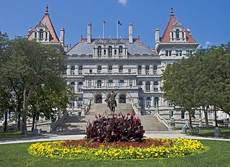
Albany
City / town · 103 listings · 6 mi away

Clifton Park
City / town · 20 listings · 11 mi away

Schenectady
City / town · 11 listings · 13 mi away

Ballston Spa
City / town · 5 listings · 21 mi away

Kinderhook
City / town · 3 listings · 22 mi away
My experience
Write about your trip here. Notes save automatically in this browser as you type; back them up from My journal.